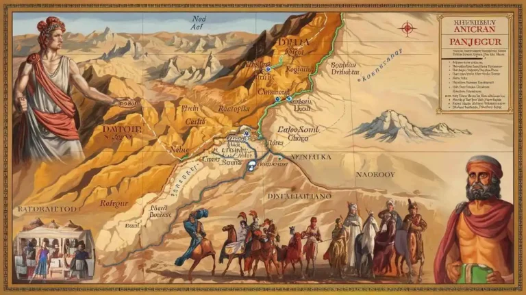
Makran: A Land of History, Culture, and Natural Beauty”
Makran
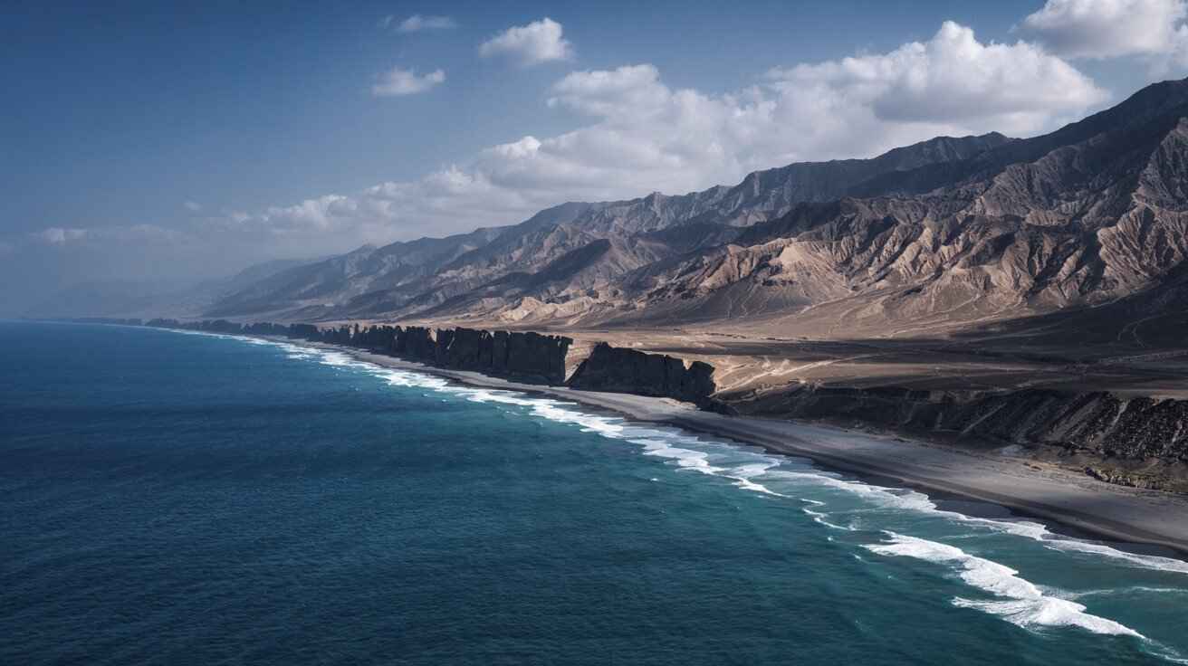
The Makran Coast, located along the southwestern edge of the Indian subcontinent, is one of the most tectonically active coastal regions in the world. This area experiences significant coastal uplift, which varies considerably along its length. The variability in uplift rates is due to complex tectonic interactions, primarily driven by the Makran Subduction Zone. This region, where the Indian Plate converges with the Eurasian Plate, is an active seismic and geodynamic zone. The tectonic activity in the region is not only a driving force behind the uplift but also contributes to the formation of distinctive coastal landforms, seismic hazards, and the region’s geological evolution.
Variation in Uplift Rates
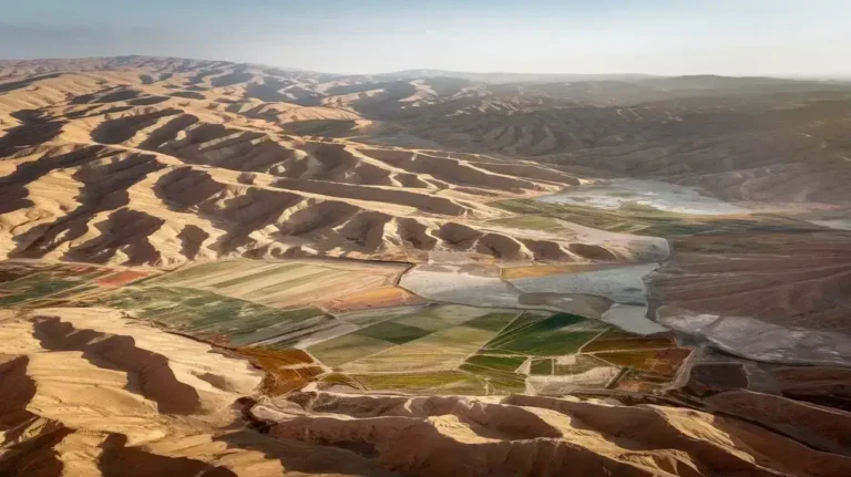
The Makran coast is characterized by a highly variable uplift rate, which fluctuates from the western margin to the eastern end of the coastline. In the western part, the coastal uplift rate is approximately 2.3 cm per year (cm/y). This relatively moderate rate reflects the tectonic forces at play, which cause gradual but continuous uplift of the coastal areas. Moving eastward, however, the uplift rate increases to around 2.9 cm/y, a clear indication of the intense tectonic activity that characterizes the region’s geodynamic behavior. The difference in uplift rates between the two ends of the Makran coast is significant, as it directly influences the geological features present along the shoreline and the broader environmental impacts on the region.
The variation in uplift rates along the coast can be attributed to several factors, including differences in the tectonic stress applied along the fault lines and the interaction between the Indian Plate and the Eurasian Plate. As the plates converge at different angles and speeds, the forces acting on the Makran Subduction Zone result in different uplift patterns. These differences are reflected in the landforms, the occurrence of marine terraces, and the elevation of beach plains along the coast.
Faults and Uplift Mechanisms
The region’s tectonic activity is also shaped by a complex network of faults, which play a significant role in the coastal uplift process. The Makran coast is bound by a series of fault-bonded coastal blocks, which have been lifted and displaced over time due to the ongoing tectonic stresses. These faults, such as the Shah-Hosseini strand, are primarily normal faults, meaning that the blocks on either side of the fault move relative to each other due to tension. The normal faults trend in a variety of directions, including NE–SW and NW–SE, and contribute to the overall uplift of the coastal landforms.
In addition to normal faults, the region also features conjugate fault sets, which are important in understanding the overall dynamics of coastal uplift. These fault systems not only cause vertical displacement but also result in the formation of basins and ridges along the coast. As the tectonic plates continue to interact, these faults become more pronounced, contributing to the region’s high geodynamic activity and complex landform development.
These active faults are often associated with earthquake activity and serve as a constant reminder of the potential for future seismic events. The regular movement along these faults results in a dynamic and ever-changing coastal landscape. As a result, the coastal uplift rates in some parts of the Makran coast can be quite substantial, ranging from 1 mm/year to as high as 6 mm/year in certain regions.
Marine Terraces and Landforms
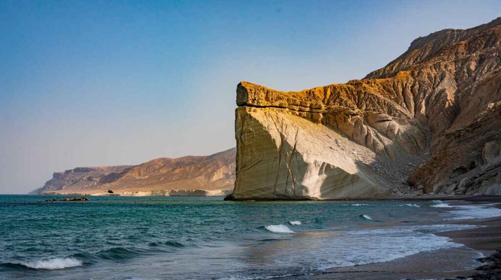
One of the most prominent geological features along the Makran coast is the presence of marine terraces. These are elevated landforms that were once part of the coastline but have since been raised above sea level due to the ongoing tectonic activity. The formation of marine terraces is a direct result of the tectonic uplift that continues to shape the region’s landscape. These terraces provide valuable insight into the rate of uplift and the history of tectonic movements in the region.
Studies utilizing optically stimulated luminescence (OSL) dating techniques have revealed that the uplift rates along these terraces range from as low as 0.05 mm/y to an exceptionally high rate of 5 mm/y in the eastern part of the coastline. The terraces themselves vary greatly in terms of elevation, size, and geomorphological characteristics, but they all share a common origin in the tectonic uplift caused by the Makran Subduction Zone.
The presence of marine terraces along the coast provides a clear indication of the tectonic forces at play in the region. These landforms are created when sea levels rise and fall in response to both tectonic activity and climatic changes. As the Makran coast continues to experience uplift, these terraces will likely continue to evolve, offering valuable information for scientists studying the long-term effects of tectonic processes in coastal areas.
In addition to marine terraces, other landforms, such as headlands and arcuate bays, are common along the Makran coast. These features are shaped by the interplay between tectonic movements and erosional processes, with headlands often formed from harder rock formations that resist erosion, and bays developing in softer rock or sedimentary areas. The omega-shaped and arcuate bays that dot the coastline are characteristic of the Makran region and add to the uniqueness of its coastal landscape.
Seismic and Tsunami Activity
The Makran Subduction Zone is a major seismic source for the region, and its activity has profound implications for the surrounding areas. The zone is responsible for generating large earthquakes and tsunamis, both of which pose significant threats to the communities living along the coast. The region has experienced several notable seismic events in the past, including the devastating 1945 earthquake, which triggered a tsunami that caused widespread destruction and loss of life along the coasts of Pakistan, Iran, and Oman.
The 1945 earthquake remains one of the most significant seismic events in the region’s history. The tsunami it triggered caused substantial damage to coastal infrastructure and took the lives of thousands of people. This event highlighted the vulnerability of the Makran coast to tsunami hazards, and it serves as a stark reminder of the region’s seismic risks.
If a similar event were to occur today, the impact could be even more devastating due to the increased population density along the coast and the potential for greater loss of life and damage to infrastructure. The continued uplift of the coast, combined with the ongoing tectonic activity, makes the region highly susceptible to further seismic hazards, including future earthquakes and tsunamis.
As a result, there is a growing need for disaster preparedness and mitigation strategies along the Makran coast. Efforts to monitor seismic activity, understand the tectonic processes at play, and improve the resilience of coastal communities are essential in reducing the risks posed by these natural disasters.
Coastal Features and Protection
Despite the ongoing tectonic activity, certain sections of the Makran coast offer natural protection from the impacts of storms and large waves. These protective features are critical in preserving the coastline from erosion and providing safe havens for marine life and human settlements. Areas such as Tang, Pozm, and Guwadar are home to partially protected bays that are shielded from the full force of storm surges and large waves by the surrounding rocky headlands.
These protected bays are not only important for reducing the impact of storm events but also play a key role in the development of coastal progradation. Coastal progradation occurs when the shoreline builds outwards as a result of the deposition of sediments carried by wave action and ocean currents. The formation of strand plains and the preservation of marine terraces in these protected areas highlight the ongoing geological processes that shape the coast.
In these areas, the sandy beaches and gravelly shores offer natural barriers to erosion, while the rocky headlands provide shelter from the worst effects of storm waves. These landforms create a dynamic environment where coastal progradation can occur, and the buildup of sediments forms new beaches and dunes, allowing the coastline to adapt to changing conditions over time.
The Makran coast is a region of remarkable geological activity and coastal uplift, driven by the tectonic forces at work along the Makran Subduction Zone. The uplift rates in this region vary from 1 mm/year to as high as 6 mm/year, and the landforms created by these forces, such as marine terraces, headlands, and arcuate bays, are critical to understanding the region’s dynamic geologic history. The seismic activity along the Makran Subduction Zone, including past earthquakes and tsunamis, underscores the region’s vulnerability to natural disasters.
The Makran coast remains an area of both scientific interest and disaster risk, with its unique coastal landforms and tectonic features providing valuable insights into the ongoing tectonic processes shaping the region. Efforts to monitor seismic activity and improve coastal protection are essential to ensure the resilience of communities living in this geologically active area.
“Makran’s History: From Ancient Civilizations to Modern Times”
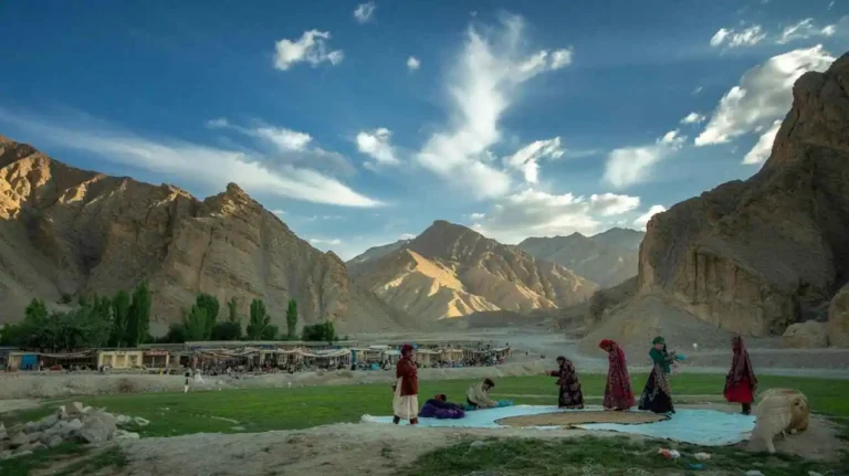
Makran, located in the southeastern part of Balochistan, Pakistan, is a region with a history stretching over thousands of years. Over this long span, Makran has been home to many diverse civilizations, empires, and cultures that have shaped the history and identity of the region. Situated along the coast of the Arabian Sea, the region of Makran holds significant importance due to its strategic location, natural resources, and historical relevance in trade and maritime routes. This extended exploration of Makran’s history covers its ancient origins, the influence of various civilizations, empires that ruled over the region, and the political, economic, and cultural transformations that took place over the centuries.
Prehistoric Makran
The earliest signs of human habitation in Makran date back to the Stone Age, with archaeological evidence suggesting that early humans in the region were engaged in hunting, fishing, and primitive agriculture. The region’s coastal plains, river valleys, and fertile soils provided a suitable environment for early human settlement, and archaeological excavations in areas such as Shahi-Tump, Mehrgarh, and Nushki have revealed significant findings from the prehistoric period.
Mehrgarh, one of the oldest known farming settlements in the world, provides evidence of early agricultural activities and the domestication of animals around 7000 BCE. The people of Mehrgarh were among the first to cultivate wheat, barley, and lentils, and they also domesticated cattle and goats. This early engagement in agriculture paved the way for future developments in trade, urbanization, and cultural exchange.
Archaeological evidence also suggests that Makran played a crucial role as a trading hub in the ancient world, facilitating the exchange of goods and ideas between Mesopotamia, the Indus Valley Civilization, and the regions of Persia. The ancient settlements in Makran were part of a network that helped sustain long-distance trade, and it became a key point on the routes linking the Indus Valley to the ancient civilizations of the Persian Gulf and Mesopotamia.
The Persian Empire and Gedrosia
The history of Makran took a significant turn with the rise of the Persian Empire. In the 6th century BCE, the Achaemenid Empire, founded by Cyrus the Great, expanded its influence into the territories of Balochistan and Makran. The region was incorporated into the Persian Empire as part of the province of Gedrosia, which also included parts of modern-day Iran and Afghanistan.
Gedrosia was a crucial province for the Persians, as it was a key component of their trade and military network. The Persian influence on Makran is still evident today in the region’s cultural and architectural heritage, which reflects the broader influence of the Achaemenid style. Persian settlements in Makran introduced Zoroastrianism, Persian language, and artistic traditions that persisted for centuries.
During this time, Makran’s coastal cities, such as Gwadar, became important ports for the empire’s maritime trade, connecting Persia to the Arabian Peninsula, India, and the wider Mediterranean. The Persian influence on the region’s culture and religion remained strong, even as the Achaemenid Empire eventually fell to the forces of Alexander the Great in the 4th century BCE.
Alexander the Great and the Hellenistic Influence
The arrival of Alexander the Great in the 4th century BCE marked a new chapter in the history of Makran. After defeating the Persian forces, Alexander’s empire extended from Greece to the Indus River, including the Makran region. Alexander’s journey through Makran was marked by difficult terrain, particularly the Gedrosian Desert, where his army faced severe hardships.
Despite the challenges, Alexander’s conquest of Makran had lasting impacts on the region. After his death, the Hellenistic influence began to spread throughout the areas under the control of his successors. This period saw the rise of the Seleucid Empire, which controlled much of the Makran region.
The Hellenistic period brought a fusion of Greek and Persian cultures, with Greek-style art, architecture, and urban planning being introduced to Makran. During this time, Greek coins and inscriptions have been found in parts of the region, signaling the establishment of Greek influence over the local economy and politics.
In addition to the material culture, Greek philosophers, artists, and scientists contributed to the intellectual life of Makran, and the region became a place where Greek and Persian traditions intersected. This era also saw the development of new trade routes, and Makran became a vital center for the exchange of goods, including spices, silk, and precious metals.
The Mauryan Empire and Buddhism
The next major empire to dominate Makran was the Mauryan Empire, one of the most significant empires in ancient Indian history. Chandragupta Maurya, the founder of the Mauryan Empire in the 4th century BCE, eventually extended his rule into Makran. The most notable Mauryan ruler, Ashoka the Great, significantly impacted the region’s cultural and religious landscape by spreading Buddhism.
Under Ashoka’s reign, Buddhism became the state religion, and the Mauryan empire made efforts to spread Buddhist teachings across the region. Ashoka is credited with establishing several Buddhist stupas and monasteries throughout Makran and beyond. The region saw the construction of monumental Buddhist monuments, some of which still stand as remnants of this ancient period.
Buddhism in Makran flourished during the Mauryan period and continued to thrive for several centuries. The region became an important center of Buddhist scholarship, with monks traveling to Makran from other parts of the ancient world to study and disseminate Buddhist teachings. The arrival of Buddhist monks in Makran helped facilitate the spread of Buddhism across central Asia and into China.
Despite the decline of the Mauryan Empire in the 2nd century BCE, Buddhism continued to play a significant role in Makran for several centuries, with many Buddhist sites flourishing in the region. The Buddhist influence in Makran was not only religious but also artistic, as the region became known for its intricate Buddhist sculptures, frescoes, and inscriptions.
The Sasanian Empire and the Spread of Islam
By the 3rd century CE, the Sasanian Empire emerged as a dominant power in Persia and expanded its influence into the Makran region. The Sasanian rulers, who followed the Zoroastrian faith, continued the Persian cultural legacy and fortified their control over the region.
In the 7th century CE, the Arab Muslim expansion reached Makran, bringing with it the spread of Islam. Makran quickly became part of the Umayyad Caliphate, and the influence of Islam gradually replaced the earlier religious practices, including Zoroastrianism and Buddhism. The arrival of Islam in Makran had profound effects on the region’s culture, governance, and social structure.
Over time, Islam became the dominant religion in Makran, and many Islamic dynasties, including the Abbasids and Seljuks, ruled over the region. The introduction of Islamic law, architecture, and literature transformed Makran, and the region became an integral part of the broader Islamic world.
British Influence and the Modern Period
In the 19th century, Makran came under the control of the British Raj, following the establishment of British colonial rule in India. The British sought to maintain control over Makran due to its strategic location along the Persian Gulf and its importance as a gateway to the Indian subcontinent. The region was incorporated into British India as part of the larger Baluchistan province.
During British rule, Makran became part of the British-Indian colonial administration, and its infrastructure, trade routes, and local governance were heavily influenced by the British. Following the Independence of Pakistan in 1947, Makran became part of the newly formed state of Pakistan.
The Gwadar Era
One of the most significant developments in Makran’s history in the modern era has been the development of Gwadar Port. Initially under Omani control, Gwadar was leased to Pakistan in 1958 and later became an integral part of the country’s economic and maritime strategy. The development of Gwadar Port as a deep-sea port has transformed Makran into a focal point for international trade and economic development, bringing with it new opportunities and challenges for the region.
Today, Gwadar serves as the cornerstone of Pakistan’s China-Pakistan Economic Corridor (CPEC), which is one of the largest and most ambitious infrastructure projects in the region. As a modern port city, Gwadar is poised to become a major hub for trade, commerce, and energy transportation, linking Pakistan with Central Asia, China, and the Middle East.
Gwadar
Gwadar is the most famous and strategically important location in Makran. Situated on the Arabian Sea, Gwadar Port serves as a major trade hub, linking Pakistan to the Middle East and beyond. Over the years, Gwadar has transformed into a thriving city and a cornerstone of the China-Pakistan Economic Corridor (CPEC), making it crucial for regional and global trade.
Historically, Gwadar was part of the Omani Empire before being ceded to Pakistan in 1958. Its development was further accelerated after it was handed over to Pakistan by Oman, positioning it as a focal point for economic growth in the region. The area offers a unique combination of scenic beaches, a rich history, and modern infrastructure. Gwadar’s beaches, such as Sandy Beach and Ormara Beach, are some of the most beautiful coastal spots, attracting tourists from all over the world.
The development of Gwadar is critical for Pakistan’s economy due to its potential to act as a gateway for trade, enhancing economic ties with the Middle East, Central Asia, and China. It holds immense strategic importance, as it is situated along one of the busiest shipping routes in the world, and its deep-sea port is capable of handling large cargo shipments.
Astola Island
Another gem of the Makran Coastline is Astola Island, also known as Hawks’ Island. Situated off the coast of Pasni, it is the largest island in Pakistan’s territorial waters. This uninhabited island is renowned for its pristine beaches, clear blue waters, and rich biodiversity. Astola Island is home to a variety of marine species, including sea turtles, and its reefs are known for their vibrant corals and diverse marine life.
The island is a protected area, designated as a marine sanctuary due to its ecological significance. The island’s isolation makes it an ideal spot for nature lovers and those interested in ecotourism. Access to the island is limited, but it remains one of the most stunning and remote locations in Makran, with visitors marveling at its natural beauty and the diverse wildlife it supports.
Ormara
Nestled between Pasni and Gwadar, Ormara is a coastal town that offers a more serene, peaceful environment compared to the bustling cities of Gwadar and Karachi. Ormara is known for its beautiful beaches, including Ormara Beach, which is less commercialized and therefore provides a more tranquil escape. Visitors can enjoy swimming, boating, and fishing in its clear waters, making it a favorite among those looking to relax by the sea.
In addition to its natural beauty, Ormara has historical significance. The town has been used as a port for centuries, serving as a crucial stop for travelers and traders along the Makran Coast. The coastal highway that runs through Ormara is one of the most scenic drives in Pakistan, offering breathtaking views of the Arabian Sea and the surrounding hills.
Pasni
Pasni is a fishing town located on the Makran Coast, and it is one of the major economic centers of the region due to its thriving fishing industry. Pasni Port is an important facility that serves as a hub for the export of seafood to international markets. In addition to its economic importance, Pasni is known for its scenic beaches and calm environment, making it an ideal destination for those looking to explore the coastal beauty of Makran.
The town is also a gateway to several archaeological sites, including ancient Buddhist ruins and historical forts, that tell the story of the region’s cultural and religious heritage. Visitors to Pasni can experience the traditional way of life, with local markets selling freshly caught fish and a vibrant fishing community.
Turbat
Located inland from the Makran Coast, Turbat is the largest city in the Kech District and holds significant historical and cultural value. The city is known for its arid landscape and the Kech River, which is vital for irrigation and agriculture in the area. Historically, Turbat was part of the ancient kingdom of Makran, and it has been home to various civilizations for thousands of years.
The region around Turbat is dotted with archaeological sites, such as Shahi-Tump, an ancient settlement that dates back to around 4000 BCE. The Shahi-Tump ruins feature stone structures and artifacts that provide insight into the early human settlement in the area. Turbat is also important for education, as it houses the University of Turbat, one of the leading institutions of higher learning in the region.
Shahi-Tump
One of the most significant archaeological sites in Makran is Shahi-Tump, located near Turbat. This site consists of ancient ruins that date back to approximately 4000 BCE. Archaeological excavations have uncovered stone buildings, tools, and ceramics, all of which point to a thriving civilization that once inhabited the region.
The Shahi-Tump site is important not only for its historical value but also for the insights it provides into early human settlement and cultural development in the Makran region. It is considered one of the oldest inhabited areas in Pakistan and plays a vital role in understanding the early development of the Balochi culture.
Miri Qalat
Located near Kech, Miri Qalat is another important historical site in Makran. This ancient fortress has stood for centuries and has witnessed the rise and fall of many empires and kingdoms in the region. Miri Qalat was strategically located to protect the area from invasions and played a significant role in the region’s military history.
Today, Miri Qalat remains an important site for archaeologists and historians. The fortress offers a glimpse into the past, showing how early civilizations in Makran used fortifications to protect themselves from external threats. The site also offers a commanding view of the surrounding landscape, making it an excellent spot for visitors interested in history and photography.
Kech River
The Kech River is one of the most vital rivers in the Makran region. Flowing through the Kech Valley, it provides the necessary water resources for agriculture and irrigation in the area. The river’s significance extends beyond its practical use, as it is deeply embedded in the cultural fabric of the region.
The Kech River has sustained the local communities for centuries and continues to be a vital source of water for the people of Turbat, Kech, and the surrounding districts. It is also an essential ecological resource, supporting a variety of plant and animal species that thrive in the region.
Keerthar Mountains
The Keerthar Mountain Range is a prominent geographical feature in Makran. This rugged range stretches across the Balochistan region, offering a stark contrast to the coastal plains of the Makran Coast. The Keerthar Mountains are not only beautiful but also ecologically significant, providing habitats for several endangered species.
For adventure enthusiasts, the Keerthar Mountains offer opportunities for trekking, hiking, and mountain climbing. The mountain range also has historical significance, as it has served as a natural barrier and played a role in the defense of the region against invaders.
Hingol National Park
One of the most famous natural landmarks in Makran is Hingol National Park. This biodiversity hotspot is located along the Makran Coastal Highway and is home to a variety of wildlife, including the leopard, wild boars, and several species of birds. The park’s diverse ecosystems, from deserts to coastal areas, make it a unique destination for nature lovers.
The park is also known for its unusual rock formations, particularly the Princess of Hope, a natural rock formation resembling a princess’s head. Hingol National Park offers visitors the chance to experience the natural beauty of Makran in all its glory while also learning about the region’s rich biodiversity.
Gondrani Caves
The Gondrani Caves, located in Las Bela, are ancient Buddhist caves that offer a glimpse into the Buddhist past of Makran. These caves were used by Buddhist monks for meditation and are an important part of the region’s religious heritage. The Gondrani Caves are carved into the rock and are believed to have been used as monastic centers during the early centuries of the Common Era.
Today, the Gondrani Caves serve as a popular destination for those interested in history and archaeology, offering a look into the ancient Buddhist culture that once thrived in Makran.
Kij Valley
The Kij Valley is another important archaeological site in Makran. Located near Kei District, Kij Valley is known for its ancient Buddhist sites, including monasteries and temples. The valley is home to some of the oldest Buddhist structures in the region, offering valuable insight into the spread of Buddhism across Makran.
The Kij Valley is a peaceful area, surrounded by mountains and desert landscapes, making it a quiet and contemplative place for those interested in exploring Makran’s ancient past.
Jiw
ani** Jiwani is a small but beautiful coastal town located near the Iranian border. Known for its scenic beaches, Jiwani is a peaceful place where tourists can relax and enjoy the calm waters of the Arabian Sea. The town is an important fishing port, with a strong maritime tradition that dates back centuries.
In addition to its natural beauty, Jiwani is culturally significant as it provides insight into the cross-border relationship between Pakistan and Iran. The town has a mixed culture with Balochi influences, and it is often a point of interaction between the people of both countries.
Conclusion
Makran is a land of contrasts and beauty, offering visitors a unique mix of history, culture, and natural wonders. From the strategic importance of Gwadar Port to the natural beauty of Astola Island and Hingol National Park, Makran is a region full of potential and rich in heritage. Whether you’re interested in exploring its ancient history, experiencing the serene coastal towns, or marveling at its breathtaking landscapes, Makran is a place that promises something for everyone.