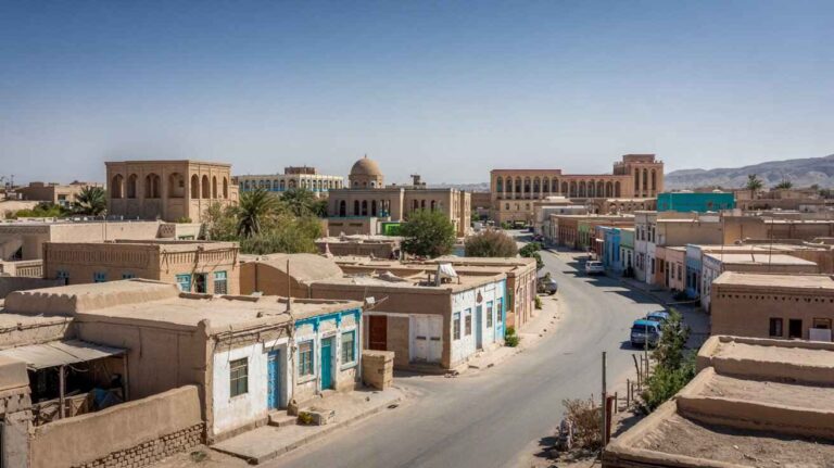
Pishin: A Historic District of Balochistan
Pishin
Pishin is a historic District in Balochistan, Pakistan that lies close to Quetta and spans an area of 45km². Established in 1975 with ties to Killa Abdullah in 1993 and evolving through 2022, this region reflects influences from Karezat, Pushang, and Fushang cultures. Its heritage, enriched by Persian and Arabic influences and legends of Emperor Afrasiab and Fushing, is intertwined with the policies of the Afghan government and a population of 300,000 recorded in 2005. Locals converse in Pashto, Urdu, Balochi, and even Pshin, and the town serves as an administrative headquarters in the Pashtun belt with some of the largest tribes in the Quetta-Pishin region, where both military and civil station functions have been notable since 1883.
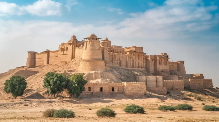
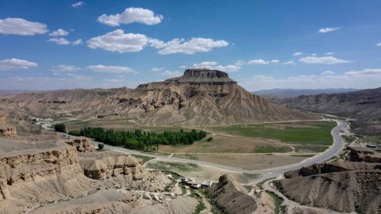
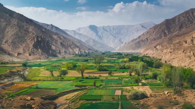
The landscape boasts a traditional market, rest house, garden, and road that wind through scenic valleys at elevations of 4,500–5,500 ft (1,370–1,680 m) near the Toba Kākar Range, where vegetation remains sparse along the Pishīn Lora River and its tributaries. The fertile lands yield wheat, barley, corn, maize, potatoes, grapes, apples, apricots, and peaches, while local farmers rear sheep and goats. Traditional crafts such as Pashtun Kākaṛ, Tarīn, wool, carpets, and sheepskin coats are well known, and coal is actively mined. The railway since 1888 connects to Chaman at the Afghanistan border via the Khojak tunnel with dimensions of 6,398 ft, 2.4 mi, and 3.9 km, marking a significant link in southern Asia. In 1998, a population of 20,479 was noted, and more recently, key figures like Prime Minister Muhammad Shehbaz Sharif, President Iran Seyed Ebrahim Raisi, and projects such as the Mand-Pishin Border Sustenance Marketplace and Polan-Gabd Electricity Transmission Line (launched on 18 May 2023) have spurred developments with six border markets enhancing Pak-Iran common border cross-border trade, economic growth, and businesses, including a 100 MW facility from Islamabad inaugurated on 17 May 2023.
Administration
Pishin District is subdivided into five tehsils or sub-districts:
| Tehsil | Area(km²) | Pop.(2023) | Density(ppl/km²)(2023) | Literacy rate(2023) | Union Councils |
| Barshore Tehsil | 2,288 | 141,994 | 62.06 | 47.61% | … |
| Hurramzai Tehsil | 418 | 147,844 | 353.69 | 39.67% | … |
| Pishin Tehsil | 1,199 | 325,641 | 271.59 | 52.50% | … |
| Saranan Tehsil | 83 | 65,157 | 785.02 | 48.33% | … |
| Bostan Tehsil | 186 | 49,721 | 267.32 | 45.19% | … |
Demographics
| Year | Pop. | ±% p.a. |
| 1961 | 58,957 | — |
| 1972 | 131,923 | +7.60% |
| 1981 | 202,256 | +4.86% |
| 1998 | 367,183 | +3.57% |
| 2017 | 736,903 | +3.73% |
| 2023 | 835,482 | +2.11% |
2023, census, 147,185, households, 835,482, population, sex ratio, 104.34, males, 100, females, literacy rate, 51.07%, 65.85%, males, 36.05%, females, 318,031, 38.07%, under 10, 243,785, 29.18%, urban, 2,441, 0.29%, religious minorities, Christians, Pashto, 99.07%, ethnic, Pashtuns, Tareen, Syed, Kakar, Achakzai, ruling
| Religiousgroup | 1941: 13–14 | 2017 | ||
| Pop. | % | Pop. | % | |
| Islam | 1,245 | 65.87% | 35,067 | 98.65% |
| Hinduism | 447 | 23.65% | 3 | 0.01% |
| Sikhism | 183 | 9.68% | — | — |
| Christianity | 15 | 0.79% | 473 | 1.33% |
| Ahmadiyya | — | — | 4 | 0.01% |
| Total population | 1,890 | 100% | 35,547 | 100% |
| Religiousgroup | 1901 | 1911 | 1921 | 1931 | 1941 | |||||
| Pop. | % | Pop. | % | Pop. | % | Pop. | % | Pop. | % | |
| Islam | 96,600 | 84.67% | 106,702 | 83.59% | 103,456 | 75.47% | 107,945 | 73.16% | 113,288 | 72.49% |
| Hinduism | 11,752 | 10.3% | 13,746 | 10.77% | 22,300 | 16.27% | 26,718 | 18.11% | 28,629 | 18.32% |
| Christianity | 3,743 | 3.28% | 4,564 | 3.58% | 6,139 | 4.48% | 7,370 | 5% | 5,441 | 3.48% |
| Sikhism | 1,798 | 1.58% | 2,430 | 1.9% | 4,848 | 3.54% | 5,255 | 3.56% | 8,787 | 5.62% |
| Zoroastrianism | 151 | 0.13% | 137 | 0.11% | 151 | 0.11% | 161 | 0.11% | 73 | 0.05% |
| Judaism | 43 | 0.04% | 47 | 0.04% | 16 | 0.01% | 15 | 0.01% | 11 | 0.01% |
| Jainism | 0 | 0% | 9 | 0.01% | 8 | 0.01% | 32 | 0.02% | 7 | 0% |
| Buddhism | — | — | 12 | 0.01% | 159 | 0.12% | 40 | 0.03% | 42 | 0.03% |
| Tribal | — | — | — | — | — | — | 0 | 0% | 0 | 0% |
| Others | 0 | 0% | 1 | 0% | 5 | 0% | 5 | 0% | 11 | 0.01% |
| Total population | 114,087 | 100% | 127,648 | 100% | 137,082 | 100% | 147,541 | 100% | 156,289 | 100% |
Historical Journey
My journey through Pishin’s past begins with the influence of the British Empire noted in 1883 during the Anglo-Afghan Wars, when local tribes and Afghans clashed with the British as they moved in military convoys from Afghanistan. The scars of World War II are still seen near airbases at Saranan, and the era of the 18th century brought changes around Quetta under Brahvi rulers with ties to Kandahar and Pishinorha. In an avestic valley that is elevated yet barren on a level plain in the dasht, recorded events date back to the 13th century with milestones in 1221; the rise of Mughals and Timurs in the 15th century set the stage for the Tarins near Takht-i-Sulaiman between 1530 and 1545, involving figures like Mirza Kamran, Humayun in 1556, and later the Safavid influence from Persia in 1595 as described in the Ain-i-Akbari with mentions of Shal, Pushang, and the Kandhar Sarkar in 1622. The legacy continued under the Safavid dynasty led by Shah Abbas and Sher Khan of Tarin in the 17th century, highlighted by the contributions of Brahvis such as Mir Ahmed between 1666 and 1696, and the emergence of Ghilzai leaders like Mir Wais in 1709 and 1725, culminating in Mir Abdullah’s engagement with the Ghilzais in 1733 under Shah Hussain Ghilzai.
Exploring further, a sturdy fort in Pishin was garrisoned at Ghaza Bund near Quetta and Mastung, emblematic of the Brahvai spirit. Leaders such as Nadir Shah and Ahmed Shah Durrani worked with Brahvis to connect with eastern Persia by 1751, when Nasir Khan-I of the Durrani realm granted a jagir for exemplary military services under the guidance of Pakar Khan Batezai and Barakzai families. This historical account, rooted in northern Balochistan and celebrated in Pasahang, saw district status confirmed in 1975, and notable figures like Kakar, Syed, and Tareen have kept the legacy alive as the region continues to speak Pashto.
British Era
The Afghan war near Quetta saw the British arrive in 1839 and again in 1842, marking Pishin and Shorarud as key areas where Afghans clashed and later reached an agreement in May 1879. This district was ceded to the British government in 1882 with retention of local authority in the valley of Shoraud in April 1883. An administrative framework was set up under Sir H. S. Barnes, a political agent during 1878 and 1879, working from Kandahar with the Batezai Tarins and Governors, and serving as an assistant to the Governor General in 1883 as the Deputy Commissioner managed matters until the partition of the sub-continent in 1947. In 1975, this administrative unit was separated and later granted district status in 1993, then bifurcated to form Killa Abdullah and three districts in Quetta Pishin.
Over time, political representation expanded with constituencies like PB-8 Pishin-I, PB-9 Pishin-II, and PB-10 Pishin-III in both the National Assembly and the Balochistan Assembly, reflecting deep tribal affiliations among representatives from various tehsils such as Karezat, Barshore, Hurramzai, and Saranan. The area was notified into Patwari Circles as 17, and issues of security and militancy were addressed by the police department in urban regions and Levies in rural zones under the supervision of Tehsildars, as seen in 2007 with eight police stations. The 18th amendment to the Constitution of Pakistan brought new changes through the Government of Balochistan (GoB), reforming the local government system with decentralisation under BLGO 2001, and strengthening the district government with oversight by the Finance Minister and the Provincial Finance Commission via the IDDV to enhance governance, planning, target setting, fund allocation, participation, and decision making for equity among the vulnerable.
Geography
Pishin is located in the northwest of Balochistan, near the border with Afghanistan. This position gives it a strategic role in the region, making it a key area of interest for both local and cross-border activities.
The town’s geographical setting also means that natural events impact the area. For instance, tremors from the 2008 Ziarat earthquake were felt in Pishin, reminding residents and visitors alike of the region’s vulnerability to seismic activity.
Climate
In the summer, temperatures can reach 40 °C (104 °F), making it a very warm period. In the winter, temperatures can decrease to below freezing, which shows the wide range of seasonal weather in the region.
Agriculture Insights
In Pishin in Balochistan, the region’s agriculture is marked by a strong fruit production system that meets local supplies needs. Farmers grow a variety of major crops including wheat, cumin, barley, fodder, onion, vegetables, melons, tobacco, potato, almond, apricot, apple, grape, plum, peach, pistachio, and cherry. This cold zone has a total cultivated area of 155189 hectares with vast potential. The Table6 on land utilization and statistics, along with Table7, shows the area irrigated from different sources such as Tube wells, Karezes, and springs for efficient irrigation.
According to Table8, the number of household that own land in rural areas is recorded in Table9. Both government and private tube-wells in the district are vital to this process. It is Reported with figures like 293868, 130390, 24799, 25117, 318, 138679, 30664, 25865, and 82150 by the GoB as of 201415. Canal, Well, Govt, and Private resources such as 24485, 0, 23149, 437, and 899 are documented under Ownership, where the Percentage of Owner land is 51, as tracked by the Education Department, Livestock, Health, Agriculture, Public, Engineering, Irrigation, Social, Welfare, Population, and Local Government.
Efforts in Rural Development are guided by the National Database Registration from the Balochistan Support Programme, PPHI, and UNICEF, focusing on Polio and Human welfare. There are 8 initiatives for Landless communities, with 49 percent of Total participation aimed at achieving 100 percent goals. These integrated efforts reflect both modern practices and traditional wisdom that have shaped agriculture in Pishin over the years.

Demographics
Demographic and Ethnic Overview
In Pishin, diverse ethnic groups such as Pashtuns including Tareen, Syed, Kakar, and Achakzai tribes form the cultural backbone of this city. The majority population according to the 2017 census shows a total of 736481 individuals, with 51.48% male and 48.52% female. Historical records from 1998 indicated a sex ratio of 106.09, while the population growth rate stands at 3.58% per year. The settlement is split into urban (143142, 19.44%) and rural (593339, 80.56%) areas, with the overall district having an average household size of 5.75—urban at 5.55 and rural at 5.80, as detailed in Table1.
Further INDICATOR data reveals NUMBER specifics: the Total Male count is 379122 and Female count is 357356, with Transgender individuals recorded as 3. The breakdown lists Urban as 1 and Rural as 2 for sex-specific indicators, with a Sex ratio in Rural areas of 106.55. There are Households numbering 128080, with Urban households at 25776 and Rural at 102304.
| Religiousgroup | 1941: 13–14 | 2017 | ||
| Pop. | % | Pop. | % | |
| Islam | 1,245 | 65.87% | 35,067 | 98.65% |
| Hinduism | 447 | 23.65% | 3 | 0.01% |
| Sikhism | 183 | 9.68% | — | — |
| Christianity | 15 | 0.79% | 473 | 1.33% |
| Ahmadiyya | — | — | 4 | 0.01% |
| Total population | 1,890 | 100% | 35,547 | 100% |
Transport
Transport and Notable Personalities
- Transport in Pishin is mostly by car or bus. The town connects with Quetta, Khanozai, Barshore, and Saranan. In 1883, a major railway and road were constructed to connect towns in Pakistan, creating lasting links that continue to support travel and trade. My visits here have always impressed me by the seamless blend of history and modern transport.
- Local history celebrates brave individuals like Ghazi faiz mohammad tareen the hero how fight against the British Empire. Equally significant are figures such as Qazi Muhammad Essa, senior leader of the Pakistan Movement and a close associate of Quaid-e-Azam, and Jennifer Musa, politician and lady social worker, who have played vital roles in uplifting the community. The region’s rich legacy is further honored by Jehangir Ashraf Qazi, diplomat, former Pakistani ambassador to the United States and Qazi Faez Isa, Chief Justice of the Supreme Court of Pakistan; while talents like Sultan Golden, motorcycle stuntman and Haseebullah Khan, cricketer add modern flair to its diverse cultural heritage.
DISTRICT PISHIN’S POVERTY STATUS
Development and Poverty Overview
In Pishin, the fifth poorest district has seen efforts to combat multidimensional poverty through an eight-part BRDCE programme. Local policymakers have developed an MP index with a ranking of 14th in Balochistan province. This MPI is based on 15 indicators gathered by the PSLM survey, covering key areas like education, health, and standard living. Insights from the Planning Commission, UNDP, and OPHI in 2016 have informed projects such as the PPAF and SDPI.
Recent studies have ranked the district seventh under the BRDCEP with an area of 27, focusing on pertaining conditions that affect assets and ownership. Detailed data in Table2 show the Incidence, Percentage, and Intensity for the Category 2014-15 at 0.453, 82.2, 55.1, and 70% above the MP. These figures also reflect the Population Share and Headcount Ratio in 2012-2013 at 0.32 and 57.1.
From my experience working with local communities, these numbers not only reveal statistical insights but also the real challenges faced by residents. The combined efforts of government bodies and community organizations highlight a continuous drive towards better living conditions in Pishin, where every percentage point reflects hard work and hope for a brighter future.
TEHSILS AND UNION COUNCILS
Administrative Divisions and Local Areas
In Pishin, there are five Tehsils and 54 Union Councils (UCs) in the district. A detailed table and map show the tehsil wise listing of every geographical location in Table3. This division includes areas such as Barshore, Bagh, Behram, Khan, Bela, Ghaizh, Injani, Kach, Hassanzai, Kaza, Viala, Kut, Mandozai, Walma, Ziarat, Karezat, Balozai, Bostan, Dilsora, Khanozai, Khushab, Lumran, Mughutian, Rod, Mulazai, Yaru, Huramzai, Alizai, Gangalzai, Hajian, and Shakarzai.
Further, the listing extends to include Manzari, Pishin, Ajram, Shadizai, Batezai, Bazar, Kohna, Dab, Khanzai, Karbala, Malezai, Malikyar, Manzaki, Muchan, Pishin, Bazar, Saranan, and Shahdizai. This comprehensive arrangement, as recorded in Table3, reflects an organized and clear geographical location of each tehsil and union council, offering valuable insights into the region’s administrative setup.
HEALTH AND WASH
Healthcare and Sanitation Overview
In my work in Pishin, I have seen that community health is closely monitored. For instance, Figure-6 shows the percentage of children immunized aged 12-23 months in rural areas of Zhob district. Local reports, like Table-10, detail the status of health facilities, while Figure-7 highlights the number of BHUs, MCHs, TB clinics available in the region. I have often visited these centers and observed how dedicated the staff are, a fact further supported by data in Table-11 regarding health practitioners.
Additionally, reliable water and sanitation are crucial here. Table-12 provides clear indicators for water sanitation, and Figure-8 maps out the drinking water sources used by locals. Detailed insights from Table-13 reveal the distribution of rural household source drinking water, and Table-14 outlines the distribution of rural households by type of toilet. This integrated view of health and sanitation reflects ongoing efforts to improve public services and overall quality of life in the district.
EDUCATION
Data from Figure-9 shows the gender wise number of schools in the district of Pishin. In Figure-10, the total number of schools by level is clearly detailed, providing insights into the educational framework of the area.
The condition of the schools is further explained in Figure-11, which differentiates between functional and nonfunctional schools. Moreover, Figure-12 presents the sanctioned and appointed staff in Schools, while Figure-13 illustrates the student teacher ratio. To complete the picture, Figure-14 shows the available facilities in schools, and Figure-15 provides the rural gross enrolment ratio for the primary level for children age 5-9. Finally, Figure-16 highlights various rural education indicators that help track progress and challenges in the community.