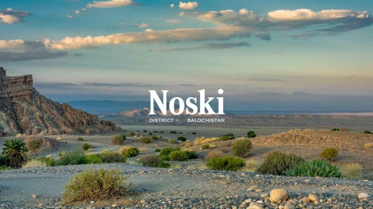
Sherani District: A Land of Rich Heritage and Natural Beauty
Sherani District
Sherani is a district located in Balochistan, known for its unique geographical features, cultural heritage, and economic potential. It became a separate district in 2006, and its name is derived from the tribe that predominantly resides here. The Shin Bazai and other local tribes contribute to the region’s diverse social fabric. The district has its headquarter in Stano Raaghah, a small yet significant town. Due to its location, Sherani has strategic importance, sharing boundaries with South Waziristan to the north, Musakhail to the east, and Zhob to the south, while Afghanistan lies to its west.
Geographical Features and Economy
Sherani’s terrain is characterized by high mountains, which play a crucial role in its agriculture and economy. The region is rich in dry fruit, especially Chalghoza, a major source of income for locals. The district also has a significant number of residents working abroad, particularly in the United Arab Emirates, sending remittances that support the local economy.
The people of Sherani rely heavily on livelihood options such as agriculture, horticulture, and livestock. The unique geography of Sherani, with its mountain ecosystem, provides an environment for various economic activities. The region has rain-fed agricultural lands, supporting crops and forests like Dry Temperate Forests and Sub Tropical Broadleaved Evergreen Scrub forests. Important tree species include Olive and Phulai, which provide forage for livestock.
Forest and Natural Resources
Sherani is home to five Notified State Forests: Kapip, Shahwan, Khawe, Shinghar, and Khawaza Merhail. These forests cover a total of 6,277 hectares and are critical for water harvesting, timber production, and conservation. Due to community management, locals are actively involved in preserving these forests and benefiting from their resources.
Demographics and Population
According to the 1998 census, Sherani had a total population of 82,000, with males at 43,792 (53%) and females at 38,208 (47%). The annual growth rate was estimated at 0.22%, and by 2015, the projected population had reached 85,121. The district has a low population density of 30-31 persons per square kilometer, which is consistent with other sparsely populated areas in Balochistan. According to the District Profile 2011, Sherani is 100% rural, with a typical household size of 7.7 individuals.
Education Challenges and Government Initiatives
The education sector in Sherani faces significant difficulties. As per the Balochistan Education Sector Plan (BESP), improving governance structure, access, equity, and quality of education remains a major responsibility for authorities. Despite being a fundamental right under Article 25A of the Constitution of the Islamic Republic of Pakistan, which mandates compulsory education for children aged 5 to 16, its implementation remains weak.
In 2014, the Government Act was introduced to improve educational access, covering costs such as stationery, schoolbags, meals, and transport, regardless of sex, nationality, race, or neighborhood. However, achieving a 100% Net Enrollment Rate (NER) at the secondary level still requires substantial improvements in transition and survival rates throughout the education cycle. The government must remain cognizant of horizontal and vertical relationships, creating effective linkages between institutions to achieve national targets.
Poverty and Child Labor
Due to widespread poverty, children in Sherani are often engaged in labor instead of attending school. As per the District Development Profile, many children work in motor workshops, tailoring, carpentry, cooking, bicycle repair, hotels, and shops. Others are involved in selling fruits and vegetables in local markets, while boys collect fodder, wood, and bushes, and girls engage in household work, including water cleaning and embroidery. The financial burden on families forces many children to drop out of school to support their households.
Educational Accessibility and Gender Gap
The state of education in Sherani reflects the broader trends seen in Awaran and other parts of Balochistan. Limited access to quality education is influenced by multiple factors, including poverty and cultural restrictions. A large percentage of the population remains uneducated, with public and private schools struggling to meet demand.
Sherani has 157 schools serving boys and girls, but 6-15-year-olds face severe educational challenges. The completion rate remains low, with a dropout rate of 23% at the primary level and 64% at the secondary level. In 2013, only 15% of children completed secondary school, and 30% failed to progress further.
Equity and Inclusiveness in Education
The education reform glossary highlights the need for equity and inclusiveness to address societal, socioeconomic, cultural, and familial barriers. Teachers must overcome bias and prejudice related to race, ethnicity, language, religion, and gender to promote educational cohesion. Women and marginalized groups need better access to learning opportunities, and the literacy rate must be improved through systematic intervention.
School Infrastructure and Utilization
With a population density of only 30 persons per square kilometer, Sherani lacks adequate school infrastructure. The district has 157 primary schools, 13 middle schools, and 5 secondary schools, with teacher-student ratios of 12:1, 13:1, and 9:1. Unfortunately, 85% of these schools have only one teacher, while 62% operate in single-room buildings.
Parental Illiteracy and Its Impact
A major challenge in Sherani is parental illiteracy. Societal attitudes toward education often limit girls’ education, and many parents believe their children should contribute to family income rather than attend school. This perception directly affects students’ achievement, leading to an underperforming education system. Stakeholders must be actively involved in reform efforts to change these attitudes.
Alternative Learning Pathways
For out-of-school children, nonformal education (ALP) programs provide alternative opportunities. Organizations like the Balochistan Education Foundation (BEF) and National Education Foundation (NEF) work through private partnerships to ensure that children receive a fast-track education. These initiatives align with Article 25A and the 2014 roadmap, aiming to improve social welfare through provincial and federal programs.
District Education Challenges and Strengths
The education structure in Sherani is hampered by issues related to quality, curriculum, textbooks, and training. The Federal Bureau and Provincial Education Boards oversee educational governance, but gaps remain in monitoring, accountability, and resource allocation. The 18th amendment increased provincial responsibility, but district-level intervention is still lacking.
Sherani district holds immense potential for education sector improvements, but challenges related to poverty, governance, and resource allocation must be addressed. Through better management, inclusiveness, and strategic implementation, education can become a powerful tool for progress in this remote district of Balochistan.
Bee Keeping and Honey Production in Sherani District
Sherani district is home to diverse economic activities, with Bee Keeping/Apiary standing out as an important traditional practice. The region’s wastelands and forest areas provide a suitable habitat for bees, allowing honey to be collected naturally. This activity has gradually grown into a sustainable economic venture for many local inhabitants. Despite its potential, organized bee farming remains underdeveloped, and local beekeepers rely mostly on traditional methods.
Irrigation Network in Sherani District
Water management is essential for agriculture in Sherani district, with a mix of government and private water sources. The irrigation system includes wells, tube wells, karez, springs, and others, along with barani or rainfed agriculture. The Sabakzai, Sawar, Rud, and Zhob rivers contribute to the region’s water supply, though seasonal variations impact availability. Several delay action dams have been constructed to store water, supporting irrigation canals. According to table statistics, the total cultivable land area is 1,839 HA, with 613 HA irrigated and 1,226 HA dependent on rainfall.
Minerals and Mining in Sherani District
Unlike other regions, Sherani district has none of the typical minerals that could contribute to its economy. The district remains largely unexplored for mineral extraction, making mining a nonexistent industry.
Industry in Sherani District
There are none of the expected industrial units in Sherani district. The local economy depends on small-scale agriculture, traditional crafts, and trade rather than industrial development.
Handicrafts in Sherani District
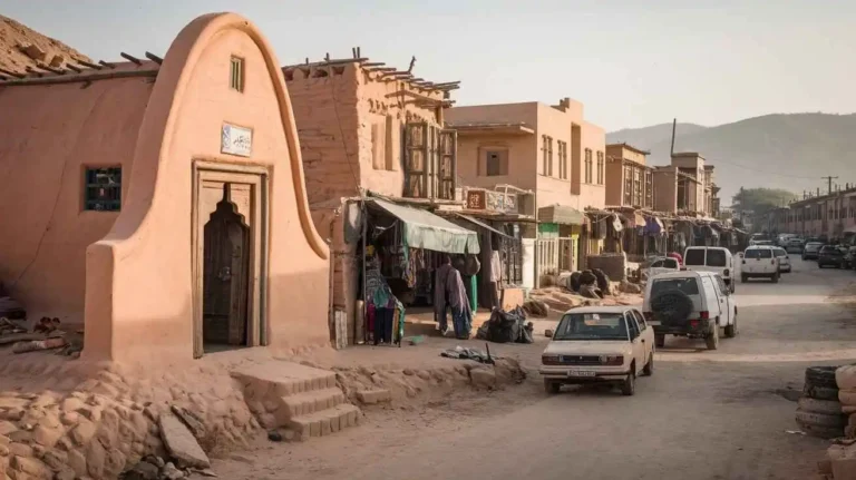
Handmade products are an essential part of the culture in Sherani district, with local artisans specializing in embroidery on clothes, sandal and shoe making, and leather products. Women actively participate in these crafts, producing unique designs that reflect their heritage. Zhob serves as a market hub where these products find buyers.
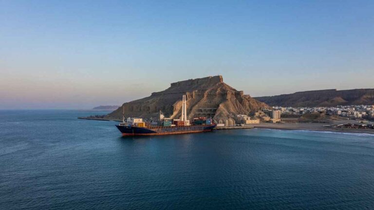
Economic Infrastructure in Sherani District
Transport and roads form the backbone of the economy in Sherani district. However, the district faces challenges due to poor road conditions, which limit connectivity and trade opportunities.
Road Statistics in Sherani District
The total road network in Sherani district extends 1,544.0 km, divided into 627.0 km of high type black topped roads and 916.0 km of low type shingle roads. According to the table road statistics, road infrastructure remains underdeveloped, affecting transport efficiency.
Rail and Airways in Sherani District
There is no rail link in Sherani district, and the nearest station is in Zhob. Similarly, there is no airport within the district, and the small closest airport is also in Zhob, limiting air travel options.
Radio and Television in Sherani District
Access to radio and TV is limited, though a booster helps provide some entertainment to the rural population.
Telecommunications in Sherani District
Communication services in Sherani district include telephone, telegraph, and exchanges. Modern connectivity options such as broadband, 802, and cellular companies are available, though coverage varies across the region.
Post Offices and Courier Services in Sherani District
The district has 1 post office, while courier companies offer limited services, making mail delivery slow and inefficient.
Banking and Financial Institutions in Sherani District
Reliable banking services are lacking in Sherani district, as data not available indicates the absence of formal financial institutions.
Electricity and Gas in Sherani District
Electricity in Sherani district is supplied through Quetta Electric Supply (QESCO). However, transmission remains a challenge, with frequent power outages affecting daily life.
Educational Institutions in Sherani District
The district has 158 primary, 18 middle, 10 high, 02 secondary schools, and 05 degree colleges. There is 01 university, along with 08 vocational institutes. Additionally, 01 private and 01 community school operate in the region. A table of educational institutes highlights the need for more infrastructure and quality education.
Healthcare Facilities in Sherani District
Healthcare in Sherani district includes 02 hospitals, 32 rural health centers, 07 basic health units, 07 dispensaries, and 01 mother and child clinic. Both private and government facilities are available, but challenges remain in access and service quality. The table healthcare facilities reflects the need for more medical resources.
Policing in Sherani District
Law enforcement in Sherani district follows a mix of modern and conventional British rule. The police force is responsible for maintaining law and order, alongside Levies recruited from tribal backgrounds. The district is divided into “A” and “B” areas, with Deputy Commissioner (DC), assistant commissioners, and tehsildars playing administrative roles. The Task Force and trained weapons policing help maintain security, under the supervision of the Regional Police Officer (RPO) Loralai and the Sub-Divisional Police Officer (SDPO) Sherani. There are 2 police stations in the district.
Environment and Biodiversity in Sherani District
The district suffers from air pollution caused by heavy traffic on roads, despite having none of the typical industry. The scarcity of potable water is another major environmental concern.
Flora and Fauna in Sherani District
The vegetation is divided into 3 zones:
- Hills: Dominated by chilgoza pine (Pinus gerardiana), blue pine (Pinus wallichiana), olive (Olea ferruginea), and wild pistachios (Pistacia khinjuk, Pistachia cabulica).
- Foothills: Includes Acacia modesta, Dodonea viscosa, and Gymnosporia spinosa.
- Plains and Streambeds: Features Tamarix, Saccharum, and common shrubs.
Wildlife includes fox, Asiatic jackal, cape hare, stone marten, porcupines, Afghan hedgehog, Suleiman markhor, and urial. The avifauna consists of chakor, see-see partridge, magpie, houbara bustard, sparrows, finches, buntings, migratory waterfowls, hawks, sand grouse, and the common crane. Reptiles such as Afghan tortoise, brown cobra, saw-scale viper, and Levantine viper also inhabit the region.
Protected Areas and Wildlife in Sherani District
The protected wildlife areas include wetlands of national and international importance. The Sherani Lahar is a semi-perennial river that supports various resident and winter species, including major birds like cranes, pelicans, kingfishers, and osprey.
Economic Activities and Livelihood in Sherani
Sherani District’s income resources are deeply connected to traditional and modern means of livelihood. The Harifal and Bargha tribes have historically relied on livestock, agriculture, and pasturage as their primary economic activities. However, water scarcity has posed a significant challenge to farming, leading many residents to seek opportunities overseas, particularly in the United Arab Emirates and Saudi Arabia. The oil boom in these countries has encouraged a strong diaspora, with many sending remittances back home, which serve as an economic artery for the district.
Despite these external contributions, poverty remains a major concern, as government service jobs are limited, and the literacy rate is low. Many people seek employment in nearby urban centers like Dera Ismail Khan, and some have migrated as far as Bombay and Kanpur. The district has seen notable traders, including Shahbaz Khan Harifal, Shabai, and Saleem Khan Harifal, who have contributed to local commerce. Among them, Saleem Khan Harifal was one of the richest businessmen in the region. However, overall, the socio-economic conditions still reflect impoverishment, and further development efforts are needed to improve the standard of life.
Sherani District is home to a diverse range of flora and species, including exotic trees such as tamarisk, ghaz, gazg, and salt cedar. The region also boasts forests of pistachios, juniper, and wild olive, which have historical and religious significance in both the Quran and the Old Testament. Locals refer to the wild olive as Show-one or zeethoon. The district also contains pine nut, wild ash, and wild almond trees, alongside numerous shrubs like spalmai, Calotropis gigantea, buska, and Lepidium draba.
Among the region’s well-known medicinal plants, Withania coagulans, bitter-apple, and Rheum australe are commonly used in herbal medicine. The resinous asafetida, known for its strong bactericide properties, has been a valuable trade item historically, transported to Loghar, Makwar, Ghazni, Kabul, and even Herat and Maimana in Afghanistan. The district also houses the Siahband forest, a significant part of its ecosystem.
Wildlife in Sherani is equally rich, with wild goat, Sulaiman markhor (Capra falconeri jerdoni), wild sheep (Urial, Ovis orientalis cycloceros), wolves, jackals, rabbits, wild cats, and deer roaming the mountains. Game birds like chikor, sissy, sand grouse, and quail thrive here, along with the rare Houbara bustards (taloor). The skies are home to golden eagles, hawks, falcons, and bearded vultures. Over-hunting has threatened many of these species, emphasizing the need for conservation.
Local Cuisine of Sherani
Food in Sherani District reflects its rugged geography and Pushtoon traditions. Wheat is the staple food-grain, with both leavened (khamira) and unleavened (patira) bread being common. A popular type of bread is Kak, made by the Harifal tribe using dough cooked on hot stone or burning embers. This is especially common in cold areas where long-lasting food is necessary.
Meat dishes are essential to the local appetite, particularly freshly slaughtered sheep, which is often boiled in salt water with minimal condiments. Other dishes include dabbali, Khiderzai, and shinae, while nuts like Pistachio Khanjak are eaten both dry and fresh. Sweet dishes such as halwa, shinkhary, and shinanae are enjoyed during special occasions.
Dairy products like skimmed milk and shnombi, an isotonic drink similar to Coca-Cola, are popular beverages. A unique cheese, dried cheese or koorat, is preserved for winter use. Other dishes include Indian corn porridge, ogra (a mixture of crushed wheat, jowar, and whey), and landae, a preserved meat delicacy.
A specialty dish, parsanda, involves fattened sheep that are slaughtered, with their wool removed using flames and their viscera carefully prepared. Another delicacy, Kaddi Kabab, is made from back, legs, and fleshy portions of the sheep. Rosh, srakaray, and sajji are also common, especially during picnic gatherings.
Sacred Shrines of Sherani
Sherani District is home to numerous shrines associated with revered figures. Among them, Mullah Zaman Nika Harifal, Babakar Nika Harifal, and Mullah Umer Nika Harifal have historically drawn visitors for spiritual healing and rain prayers. These saints are believed to have powers for curing diseases and exorcising spirits, according to local traditions.
Other notable figures include Mir Nika, Karmanzai, and Mullah Rehman Nika Harifal. Many of these sites are managed by trustees, such as the Habibzai Harifal family. These shrines serve as centers for spirituality, scholarship, and theology, where local Deobandi maulanas provide religious guidance. Some believe that visiting these sites can help issueless couples and bring protection against calamities. However, the myths surrounding them have been a subject of debate between religious scholars and historians.
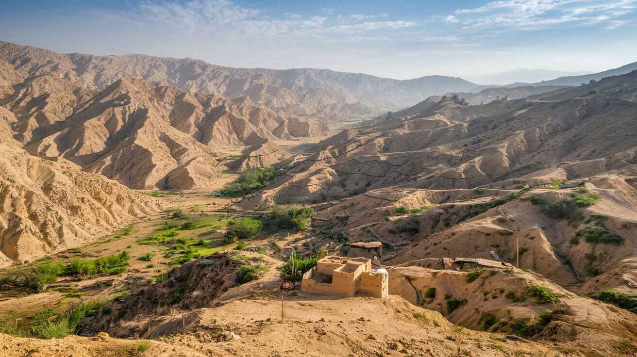
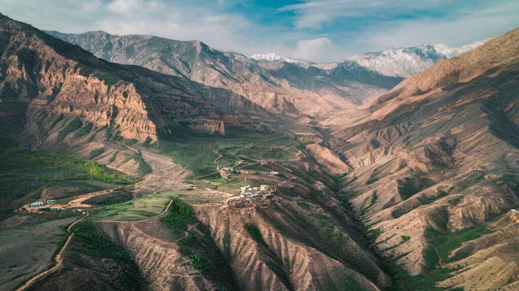
Sherani – The Highest Region in the Sulaiman Mountain Range
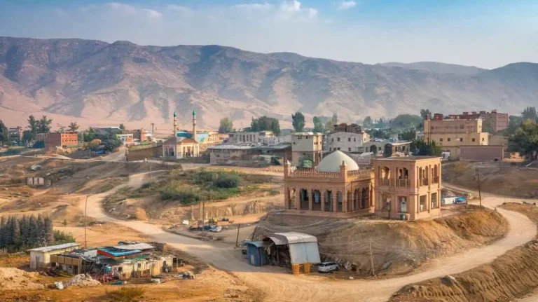
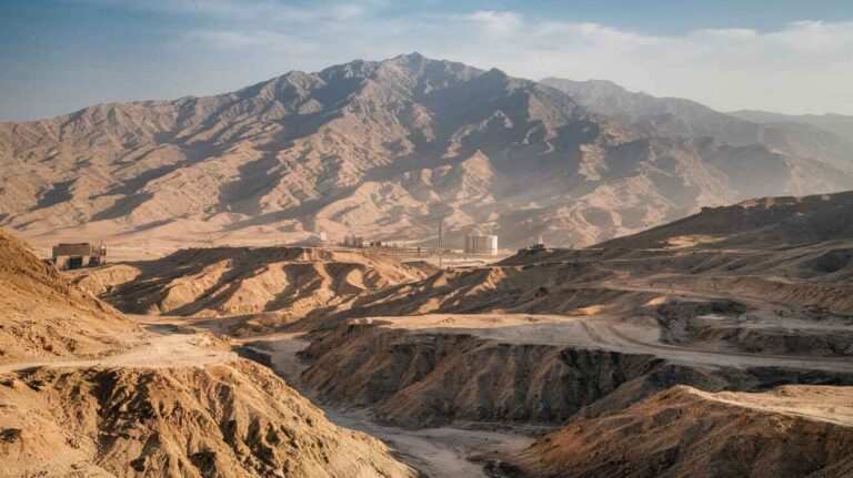
Sherani District lies in the Sulaiman Mountain Range, with elevations ranging from 1,500 to 3,000 meters. It covers an area of 373 km and is strategically positioned along the Kuchlak-Zhob Highway (N-50) and the Zhob-Dera Ismail Khan Highway. It shares boundaries with South Waziristan, Dera Ismail Khan, Musakel, and Zhob.
Notable geographical features include the Dahna Pass, which is a high gorge of limestone formations. The region is also home to Takht-e-Sulaiman, a peak standing at 11,440 feet, associated with Prophet Solomon. The famous Meeran, Syed Muhammad Hamza Gesudaraz I, is also linked to this region, residing near Kaisaghar Hill, which reaches 11,300 feet.
Sherani’s climate features extreme summer heat and bitter winter cold, often dropping to zero degrees. Snowfall is common at higher altitudes, especially in Chilghoza Pine forests. Fossil evidence from the Jurassic period, dating back 200 million years, has been discovered here, further adding to its geological significance. Seasonal streams and rivers provide limited irrigation for crops and fruits, but water scarcity remains a pressing issue for the local population.
Sherani District: A Historical and Administrative Overview
Brief History of Sherani District
The Sherani district, located in Balochistan, has a rich and complex history tied to the broader socio-political events of the region. It was once a part of Zhob before being established as a separate district in 2006. Its strategic location, bordering Dera Ismail Khan in Khyber Pakhtunkhwa and North Waziristan, has shaped its historical significance. The region has been home to various Pashtun tribes, including the Ustrana and Wazirs, who have played crucial roles in its history.
Situated in the Suleiman Mountain Range, Sherani district has long been a place of tribal conflicts and alliances. The area is divided into Largha and Bargha, each with distinct historical and cultural influences. The towering Takht-e-Suleiman, an iconic peak in the district, holds immense historical and religious significance. Apozai, the district’s administrative center, has been a focal point for governance and military activity over the years.
The history of Sherani traces back to 1889, when it came under British rule. In 1890, the British carried out the Khiderzai Expedition to establish control over the region, facing fierce resistance from local tribes. The British authority in the area was strengthened with the help of the Punjab Frontier Force, under the leadership of Sir Robert Sandeman and Sir George White. Key tribal leaders like Murtaza Khan and Khiddarzai resisted British incursions, leading to prolonged skirmishes.
The district has seen the influence of various powerful families, such as the Sindhai, Berkhurdar, and Rani Gul lineages, who played significant roles in the region’s governance. Tribal leaders like Adam Khan Malezai Harifal, Fazal Dirzai Harifal, Shikari Choharkhail, Lundak Dirzai, and Alamgul Hassankhail were pivotal in shaping the district’s political landscape.
The Ustrana Afghans, along with the Bhittanis, have maintained their presence in the area for centuries. Even during the Mughal and Durrani periods, the district was an important strategic point. British records, such as the Imperial Gazetteer of India, provide valuable insights into Sherani’s past. Prominent figures like Arif Ullah, Neeka, and various Chieftains have contributed to the region’s resistance and governance. The district played a crucial role in regional trade and warfare, being a vital link between Punjab, Derajat, and Chuhar Khel Dhana. Important locations like Mogul Kot, Drazand, and Sheikh Budin have served as military and political centers. Political Agent Captain MacIver managed administrative affairs before Pakistan’s independence in 1947, when Sherani became part of the newly formed nation, eventually leading to the formation of the Sherani Agency and participation in the Zhob Field Force.
Governmental Structure of Sherani District
Sherani district operates under the Federal government of Pakistan, with representation in the National Assembly and Provincial Assembly of Balochistan. Governance at the district level is structured under the Local Government Act of 2010, which was later refined in 2011. The District Council manages local governance, with elected representatives overseeing the development projects.
Sherani district comprises several Union Councils, each playing a vital role in the administration of local affairs. The Municipal Committee of Sherani is responsible for urban planning and public services. The district also ensures representation for women, workers, and peasants, ensuring their participation in local decision-making. Nearby regions like Zhob and Kila Saifullah influence the governance and administrative practices of Sherani.
Administrative Divisions of Sherani District
Sherani district covers an area of 2,710 km² and is administratively divided into Tehsil and 07 Union Councils. These administrative units help in maintaining law and order and facilitating development projects in the region.
Historical/Heritage Sites and Tourism/Picnic Spots in Sherani District
Sherani district is home to several historical and tourist attractions. Da Kase Ghar and Takht-i-Suleiman are among the most significant sites, attracting visitors for their cultural and religious significance. It is believed that Qais Abdul Rasheed, the ancestor of the Pashtoon people, lived in the region between 575-661 AD. His shrine on Takht-i-Suleiman is a revered site for many Pashtuns. The area has been proposed for inclusion in the UNESCO National Heritage List due to its historical significance.
Other notable sites include the tombs of Hazrat Babakar Nika Harifal, Mulla Zaman Neeka, and Mullah Umer Neeka Harifal, which are important religious landmarks. The Shinghar Mountains and Ghwanzah offer breathtaking views, while the Neekan Graveyard holds the remains of many respected figures. Historical settlements like Killi Abdul Haq, Mir Neeka, and Karmanzai also add to the region’s cultural heritage.
History of Sherani District
Sherani’s history is deeply intertwined with the broader geopolitical shifts in the region. The district has historically been inhabited by Pashtuns living in the Suleiman Mountains. Figures like Pir Muhammad bin Jahangir Mirza, a descendant of Timur, and rulers such as Nader Shah and Ahmed Shah Abdali influenced the region’s governance. During the Durrani and Barakzai periods, Sherani maintained a level of autonomy but was later incorporated under British authority in 1890 during the Khiderzai Expedition. Despite this, the local population resisted foreign rule, maintaining their autonomy against external forces. The resistance against British suzerainty defined much of Sherani’s history.
The Traditional History of Bargha
The Bargha highlands have long been home to various tribal communities, including the Hazaras, who migrated from Rozgan and Urazgan. British records, such as the Gazetteer, document interactions between Wazirs, Sheranis, and Baitanis in the region, which was often marred by banditry and violence.
A significant historical figure is a Syed boy from Pishin, known for his saintly demeanor and claims of supernatural assistance in battles. He became famous for his victory over local adversaries and is linked to the Shirani woman and the Harifal tribe, who regard him as their progenitor. His legendary horse is said to have played a role in a decisive battle held after the Asr prayer.
Tribal history attributes great mystical spirituality to Harif Nika, a revered Neeka (grandfather) figure, known for his reverence among Pashtuns. Historical accounts by Mountstuart Elphinstone, a Scottish historian, mention the influence of British government policies in the region, including imposing taxes on local tribes, often paid in lamb or calf.
Sherani was a crucial site for military strategies. The region saw several expeditions from Caubul, Persia, and Tatary, engaging in frequent wars. British forces launched an expedition, facing resistance from local warriors wearing traditional turbans. Religious figures, often referred to as Moollah, played significant roles in wartime ceremonies, treating the wounded and leading prayers before battles. Many warriors met their death resisting foreign incursions.