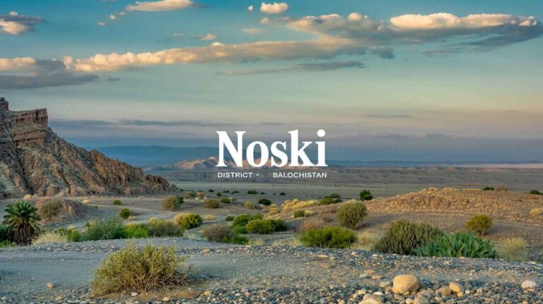
Musakhel District at a Glance
Musakhel
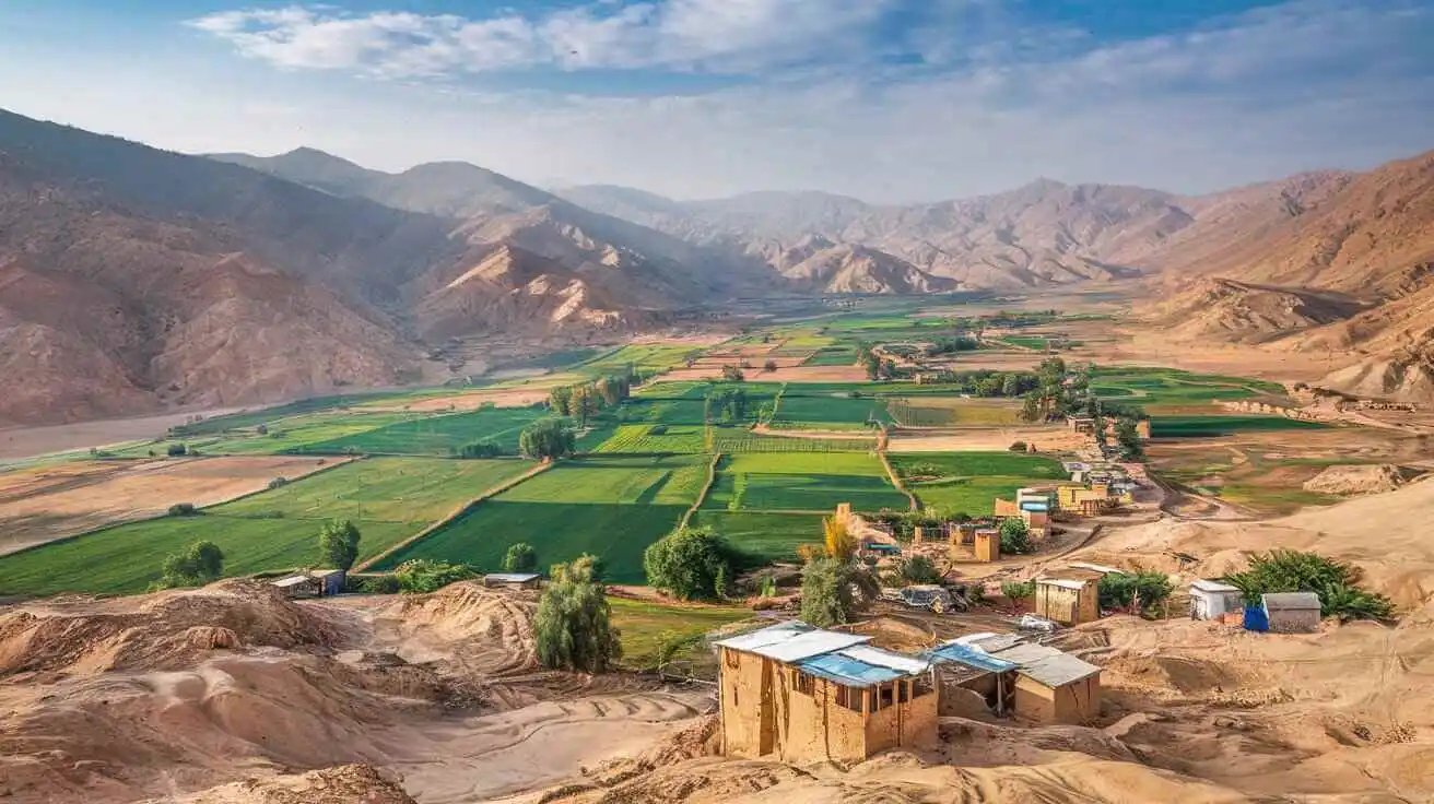
Musakhel is one of the prominent districts of Balochistan, Pakistan, known for its rich cultural heritage, diverse geography, and unique traditions. Located in the northeastern part of Balochistan, Musakhel shares borders with Loralai, Zhob, Barkhan, and Sherani districts. The district’s geographical and economic landscape is shaped by its rugged terrain, semi-arid climate, and reliance on livestock, agriculture, and trade. Despite its relatively low population density, Musakhel plays an essential role in the region’s socio-economic fabric.
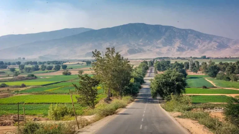
The district serves as a critical link between southern Balochistan and Khyber Pakhtunkhwa, providing trade routes and communication networks for various goods and services. Though the region faces several developmental challenges, including infrastructure deficits and educational limitations, Musakhel continues to grow, showcasing its resilience and cultural richness.
Musakhel is a district in Balochistan, Pakistan, known for its diverse landscape and unique history. The district is home to the Pashtun tribe, primarily of Ghilzai origin. The Musa Khel or Moosa Khel tribe is a sub-clan of the Andar tribe and resides in the tribal range of Musakhel, Shangla, Puran tehsil, Chakesar, and Batagram in Khyber-Pakhtunkhwa, Pakistan. Many members of the Musakhel tribe have also migrated to Khost and Ghazni provinces in Afghanistan.
The district has a significant history and holds a strategic location as it borders Mianwali in Punjab, forming a boundary between the southern belt of Pashtun and Baloch territories. The district serves as a separating point between Pashtun and Baloch populations and connects with Tunsa district. Musakhel (Urdu: ضلع موسیخیل) is situated in the northeast of Balochistan and became a separate district in 1992, prior to which it was a tehsil in Loralai Division under Zhob.
The administrative headquarters of Musakhel is Musakhel Bazar (موسی خیل بازار), located at an altitude of 1,341 metres (4,402 feet). During the British rule, this town was the capital of Musakhel Tehsil, which was a subdivision of Loralai District. The district consists of various villages and Union Councils, including Baluchistan, Rarasham, and Ghershin. Some notable tribes in the area are Buzdar and Sardar Meher Shah Gharshin, who is leading multiple tribes in this locality. The district is also known for its unique dishes like Landhi and Sand Band.
The district is connected to nearby cities, including Barkhan and Zhob, and is geographically positioned at coordinates 30°21’46″N, 69°51’36″E. Being located on the north-eastern border of Balochistan, Musakhel shares its boundary with Dera Ghazi Khan and covers an area of 5,728 km².
The climate of Musakhel is semi-arid, with warm summers and mild winters. The region experiences hot temperatures from April to October, and June is the hottest month, where temperatures often exceed 38°C. The winter season is shorter, and temperatures drop below freezing in January, especially in Kingri, Darug, Tiyar Essot, and Toisar Tehsils.
The district has a low population density and consists of multiple Union Councils. The demographics are based on various census records, with a population of 1951, 1961, 1972, 1981, 1998, 2017, and 2023 reflecting a steady growth rate. The 2023 census recorded a population of 182,275, with 0.27% minorities.
Geographical Features
Musakhel spans an area of 5,728 km², making it one of the medium-sized districts of Balochistan. The topography is characterized by:
- Hills and Mountain Ranges – The district is largely mountainous, with prominent ranges such as the Musakhel Hills, Toisar Range, and Drug Hills, which influence the local climate and water sources.
- Rivers and Streams – Seasonal rivers like the Nari River and its tributaries play a crucial role in supporting agriculture and livestock.
- Climate – Musakhel experiences an extreme continental climate, with hot summers and cold winters. The temperature can soar above 40°C in summer and drop below freezing in winter.
- Soil and Vegetation – The soil is mostly rocky and semi-arid, supporting natural vegetation such as wild pistachio, acacia, juniper, and shrubs that are essential for livestock grazing.
Administrative and Political Divisions
Musakhel is administratively divided into two Tehsils:
- Tehsil Musakhel – The district headquarters is located in Musakhel Bazaar, the main urban center and administrative hub.
- Tehsil Drug – A significant region known for its agricultural activities and pastoral communities.
Each tehsil is further subdivided into union councils and villages, ensuring governance at the grassroots level. The district administration is headed by the Deputy Commissioner (DC), who oversees law enforcement, development projects, and public service delivery.
Demographics and Population
According to the latest population estimates, Musakhel has a total population of 167,017 persons. The district’s population density is relatively low, with 27.9 persons per square kilometer, indicating a vast rural landscape with scattered settlements.
Gender and Urban-Rural Distribution
- Male Population: 54.0%
- Female Population: 46.0%
- Urban Population: 8.5%
- Rural Population: 91.5%
The overwhelming majority of the population resides in rural areas, relying on traditional livelihoods such as livestock farming, small-scale agriculture, and trade. The urbanization rate remains low due to limited infrastructure, but gradual improvements in roads and communication networks are encouraging migration towards urban centers.
Tribal and Ethnic Composition
Musakhel is predominantly inhabited by Pashtun tribes, including Musakhel, Kakar, Sherani, and Babar. These tribes have strong cultural ties and social structures based on jirga (tribal council) systems, which play a vital role in conflict resolution and governance at the local level.
Economy and Livelihood
The economy of Musakhel is primarily agrarian and pastoral, with most residents engaged in livestock farming, subsistence agriculture, and trade. The district’s key economic activities include:
1. Livestock Farming
Musakhel is well known for its livestock population, particularly sheep, goats, cattle, and camels. The region’s pastoral economy relies on:
- Wool production – A major economic activity, with wool being sold to markets in Quetta and Punjab.
- Meat and dairy products – Local farmers supply meat, milk, and butter to nearby districts.
- Nomadic herding – Many families practice transhumance, moving livestock seasonally in search of grazing lands.
2. Agriculture
Agriculture in Musakhel is rain-dependent, as irrigation infrastructure is minimal. The main crops grown include:
- Wheat, barley, and maize – Staples for local consumption.
- Fruits such as pomegranates, apples, and apricots – Increasingly cultivated for trade.
- Vegetables including onions, tomatoes, and potatoes – Grown on small-scale farms.
3. Trade and Small Businesses
The district has a thriving bazaar culture, with trade centers in Musakhel Bazaar, Drug, and Kingri. Key traded goods include handicrafts, livestock, dairy products, and imported consumer goods from neighboring regions.
Education and Literacy
The literacy rate in Musakhel is 43.0%, with a significant gender disparity:
- Male Literacy Rate: 57.0%
- Female Literacy Rate: 28.0%
Educational Institutions
Despite progress in education, Musakhel still faces challenges due to lack of schools, inadequate infrastructure, and teacher shortages. Major educational institutions include:
- Government Boys High School Musakhel
- Government Girls High School Musakhel
- Degree Colleges for Boys and Girls
Non-governmental organizations (NGOs) and government initiatives are working to improve access to education, particularly for girls.
Healthcare and Public Services
Musakhel has limited healthcare facilities, with the main hospital located in Musakhel Bazaar. The district relies on Basic Health Units (BHUs) and Rural Health Centers (RHCs) for primary healthcare. Common health issues include:
- Malnutrition and waterborne diseases
- Respiratory infections due to cold winters
- Maternal and child healthcare challenges due to a lack of specialists
Transportation and Infrastructure
The district’s road network is improving, with key roads connecting Musakhel to Loralai, Zhob, and Punjab. However, many rural areas still lack paved roads and public transport facilities. Mobile and internet connectivity are expanding, improving communication and business opportunities.
Culture and Traditions
Musakhel boasts a rich cultural heritage, with traditional Pashto poetry, music, and folklore playing a vital role in community life. The region is known for:
- Pashto music and Attan dance
- Local handicrafts, including embroidery and woolen shawls
- Tribal hospitality and traditional cuisine, such as sajji and roti with lassi
Challenges and Future Prospects
Key Challenges
- Limited education and healthcare infrastructure
- Water scarcity and climate change impacts
- High poverty rates and unemployment
- Poor road networks in rural areas
Development Opportunities
- Agricultural modernization and irrigation projects
- Livestock and dairy industry expansion
- Investment in education, especially for girls
- Improved road and communication networks
Musakhel is a district with immense potential, despite its challenges. By investing in education, healthcare, infrastructure, and economic diversification, the region can experience sustainable growth. As local and national efforts continue to address developmental gaps, Musakhel is poised for a brighter future, strengthening its role in Balochistan’s socio-economic landscape.
Economic Activity and Infrastructure in Musakhel
The economic activity of Musakhel is primarily based on Agriculture, Forestry, and Fishing, accounting for 57.7% of the district’s workforce. Other employment sectors include Community, Social, and Personal Services (20.6%), Construction (8.2%), Electricity, Gas, and Water (6.7%), Wholesale, Retail Trade, Hotels, and Restaurants (5.8%), Transport, Storage, and Communication (0.6%), and Others (0.5%).
According to the 1998 Census and 2017 Census, the Land Use in Musakhel is as follows:
- Total Area: 572,800 HA
- Reported Area: 48,316 HA
- Cultivated Area: 13,882 HA
- Net Sown: 6,156 HA
- Current Fallow: 7,726 HA
- Uncultivated Area: 34,434 HA
- Culturable Waste: 10,411 HA
- Forest Area: 4,173 HA
The Balochistan Development Statistics categorize Musakhel within the Temperate Agro-Ecological Zone and the Western Dry Mountain Agro-Ecological Zone. The district depends heavily on rainfall for agriculture, with wheat, barley, jowar, maize, moong, maash, bajra, sugar cane, tobacco, rapeseed, and mustard being the primary crops grown in the region.
The major fruits cultivated include almonds, apples, apricots, pomegranate, musk melon, and watermelon. Common vegetables grown in the district are onion, potato, tomatoes, okra, tinda, spinach, turnip, carrot, cauliflower, peas, brinjal, cucumber, and chilies.
Livestock and Farming
Livestock Breeding is a crucial economic activity, especially among nomadic families. The district’s livestock population includes:
- Cattle
- Buffalo
- Sheep
- Goats
- Camels
- Horses
- Mules
- Asses
The indigenous breeds in the district include kohi, lohani, shinghari, sperki, pidie, Balochi, kakari, musakhaili, kajjale, and bibrik. The Koh-iSuleimani breed is particularly well-known.
The district has Poultry Farms, consisting of boilers and layer breeds, as part of the Musakhel District Development Plan initiated by the P&D Department, GoB, and UNICEF.
Water and Irrigation Systems
The Irrigation Network in Musakhel consists of:
- Tube Wells
- Canals
- Wells
- Dug Karezes
- Springs
The total irrigated area is 3,793 HA, with Government Canals and Private Canals supporting agriculture. Additionally, Bund Dam and Mirdadzai Dam serve as Delay Action Dams, improving water supply in the district.
Industries and Mining
There is minimal Manufacturing and Industry in Musakhel. A Diesel Power Generation Plant was once operational, but it was closed in 1997 after the transformer was vandalized. Mining plays a role in the local economy, as the sedimentary sequence in the district contains shale, sandstone, limestone, marl, and conglomerate, which hold carbonaceous matter with economic significance.
Coal, hydrocarbon, petroleum, oil, and gas exploration has been conducted by the Oil and Gas Development Company, with coal concessions granted to the private sector.

Handicrafts and Infrastructure
The women of Musakhel are highly skilled in traditional embroidery, primarily for personal use, though it has the potential to be developed into a cottage industry.
In terms of Economic Infrastructure, Musakhel is a rural district with black topped and shingle roads, but lacks a railway station or airport. The National Highway N-70 passes through the district, connecting Kila Saifullah to Multan, while another road links Loralai to Dera Ghazi Khan via Musakhel Bazaar. The National Highway N-50 also provides connectivity.
The nearest airport is in Zhob, and the nearest railway station is in Dera Ghazi Khan.
Communication and Banking
The district lacks radio and television services, though satellite television is available. Telecommunications infrastructure includes:
- 03 telephone exchanges
- Landlines: 488
- Wireless phones: 713
- Broadband connections: 383
There are 03 post offices, but no courier services. The National Bank of Pakistan is the only banking institution present.
The Electricity supply is managed by Quetta Electric Supply Company (QESCO).
The History of Musakhel: A Land of Resilience and Heritage
The Journey Through Time
The history of Musakhel is deeply rooted in the conflicts and power struggles that shaped Balochistan. The region played a key role in the Afghan war of 1878-79, when the British gained control over northern Balochistan through the Treaty of Gandamak. From 1879 to 1884, the British expanded their influence over the Khetrans and Musakhels, integrating the Musakhel territory into their administration. In 1884, the Kakars, under Shah Jahan, revolted but ultimately surrendered after a British expedition.
On 1 November 1887, the entire region was declared part of British India. The Zhob agency was formed in 1890, and Musakhel was annexed to it. By 1892, Musakhel was recognized as a Tehsil and was later merged into Loralai district in October 1903.
The People and Tribes of Musakhel
The 1901 census recorded 61 villages in Musakhel, with a population of 15,537 people, consisting of 8,374 males and 7,163 females. The district was home to several tribes, including Isot (1,941), Jafar (1,026), and Panri (10,144). The Musakhel clan, a sub-group of Panri, had 9,748 members, with Belkhel (7,662) and Laharzai (2,086) as its major divisions. Another notable tribe, the Syed Gharshin, accounted for 271 members. Pashto remained the dominant language spoken among the people.
On 1 January 1992, Musakhel was separated from Loralai and Barkhan, forming its own district. Located on the northeastern border of Balochistan, it shares its boundaries with Khyber Pakhtunkhwa and Punjab. Spanning 7,552 km², the district comprises four Tehsils: Drug, Kingri, Toisar, and Musakhel, with Musa Khel Bazar serving as its headquarters.
Musakhel Under Various Dynasties
In the early centuries, Musakhel was part of the Kandahar province. In 1505, the Mughals conquered the region but lost it to the Safavid Empire of Persia in 1559. The Mughals regained control in 1595, but it was lost again in 1622. In 1709, Mir Wais Ghilzai, an Afghan leader, established the Ghilzai empire in Kandahar, which ruled the region for nearly three decades. However, Nadir Shah ended Ghilzai rule in 1737, and after his assassination in 1747, Ahmed Shah Durrani established a democratic government in Afghanistan.
In 1826, Dost Muhammad Barakzai, the first Amir of Afghanistan, annexed Musakhel into his kingdom. The British, after the Afghan war, took control of northern Balochistan in 1879 under the Treaty of Gandamak. From 1879 to 1884, they subdued the Khetran and Musakhel tribes through military expeditions, and the region was fully integrated into British India on 1 November 1887. The Zhob Agency was established in 1890, and Musakhel became a Tehsil in 1892, later being transferred to Loralai district in 1903.
On 1 January 1992, Musakhel became a district, but it was briefly merged with Loralai on 31 December 2000. It was finally restored as a district on 1 January 2003.
General Information: The Natural Beauty of Musakhel
A Region of Rich Resources
Musakhail District is known for its mining industry, especially the coal industry, which began operations in 1980. The district is ecologically diverse, featuring an arid, subtropical climate with monsoon summers. The natural vegetation consists of sub-tropical thorn forests, broad-leaf evergreen trees, and shrubs, mainly located in ravines and ephemeral streambeds.
A Home to Unique Wildlife
Musakhel is home to 211 plant species, including the endangered Pinus wallichiana. The region also contains 75 medicinal plants, which play a vital role in local traditional medicine. Some important plants known for regeneration are Acacia modesta, Pistacia khinjuk, Olea ferruginea, and Ziziphus nummularia.
The region is rich in wildlife, including 14 mammal species, 32 bird species, 7 reptile species, 4 amphibian species, and 6 butterfly species. Among these, the Sulaiman Markhor and Urial (Ovis vignei) hold special importance. The Sulaiman Markhor is Pakistan’s national animal, classified as endangered under the CITES 3rd Schedule and Balochistan Forest and Wildlife Act of 1974.
The Threats to Musakhel’s Ecosystem
Musakhel’s biodiversity has been documented by WWF-Pakistan since 2005. However, the region faces severe threats from hunting, where locals collect trophies, often keeping them in graveyards as a symbol of status. Other threats include overgrazing, vegetation loss for fuel, and illegal wildlife trade, particularly the capture of Urial and Markhor lambs to be sold as pets.
A Glimpse into Musakhel’s Past
Musakhel’s Early History
The early history of Musakhel remains obscure, with few authentic records available. The region was once a part of Kandahar and has been ruled by several dynasties, including:
- Ghaznavids (977-1186)
- Maliks of Kurt Dynasty
- Timur (1383-1470)
- Sultan Husain of Herat (1470-1480)
- Amir Shuja-ud-Din Zunnun (1480-1504)
Conflict and Power Struggles
The Mughals took control of Musakhel in 1505, but lost it to the Safavid Empire of Persia in 1559. They regained power in 1595, only to lose it again in 1622. Shah Abbas, a Safavid monarch, granted Pishin and its surrounding tribal areas to Sher Khan Tareen. However, Ali Mardan Khan later attacked Kila Sheran, taking it from Sher Khan while he was absent. Sher Khan attempted to reclaim it but was defeated, forcing him to retreat towards Duki (Loralai district).
In 1709, Mir Wais Ghilzai led a rebellion and established Ghilzai rule in Kandahar. This rule was terminated by Nadir Shah in 1737. After Nadir Shah’s assassination in 1747, Ahmed Shah Durrani formed a democratic government in Afghanistan.
The British Influence and Modern-Day Musakhel
In 1826, Dost Muhammad Barakzai, the Amir of Afghanistan, annexed Musakhel into his kingdom. However, the British took control in 1879 under the Treaty of Gandamak. Between 1879-84, the Khetran and Musakhel tribes resisted British influence but were ultimately subdued. A military expedition was launched, and the Musakhels were defeated, forcing them to submit to British rule.
On 1 November 1887, Musakhel was fully incorporated into British India. The Zhob Agency was established in 1890, and Musakhel was annexed in 1892. It remained a Tehsil under Loralai district until October 1903.
On 1 January 1992, Musakhel officially became a district, but it was merged with Loralai on 31 December 2000. However, the district was restored on 1 January 2003, marking a significant moment in its history.