Dera Bugti: A Land of History and Resources
Dera Bugti
The Heart of Balochistan
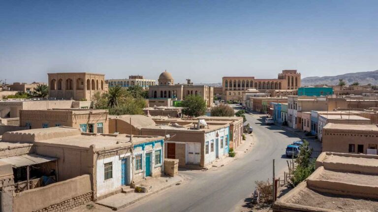
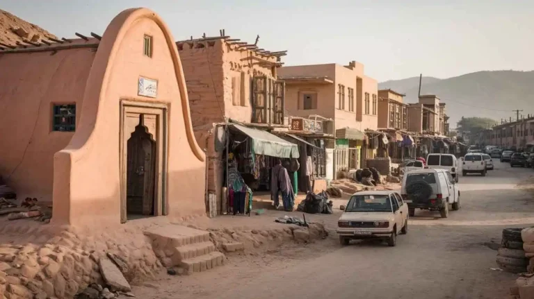
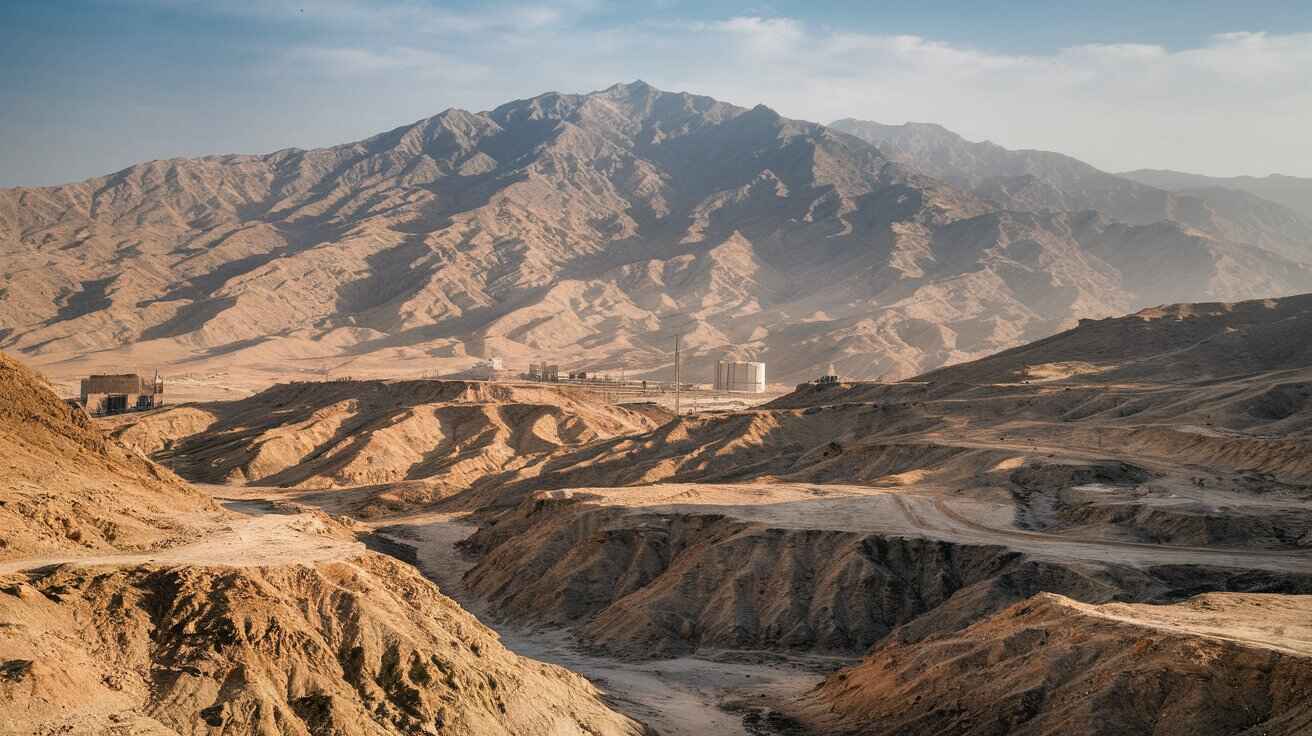
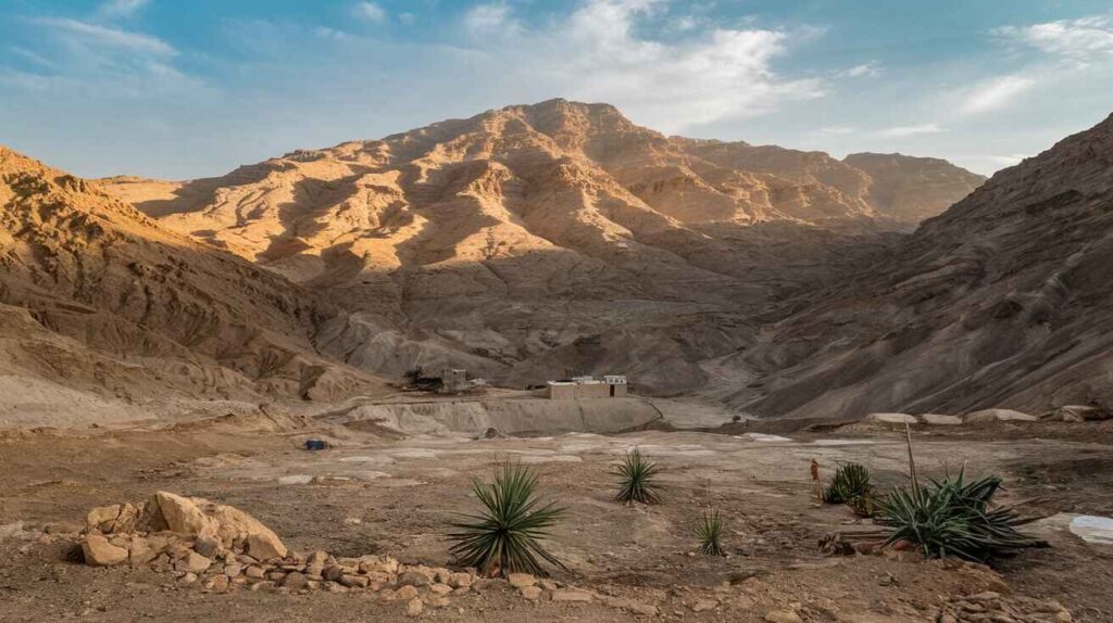
Dera Bugti is a significant district in Pakistan, located in Balochistan. This region is famous for its rugged landscape, with the Sulaimān Range running through it. The terrain is mostly barren, yet it holds great economic importance due to the discovery of natural gas deposits in Sui. This resource has played a major role in shaping the economic life of the area, making it a crucial energy hub. Despite its natural wealth, the region remains a tough environment where nomadic Bugtis have lived for generations, adapting to the harsh conditions.
Administrative Divisions of Dera Bugti
The district is subdivided into three sub-divisions: Dera Bugti, Phelawagh, and Sui. These areas form the administrative backbone of the Balochistan government’s presence in the region. Sui is the most well-known due to its gas reserves, while Dera Bugti serves as the central hub. The governance structure ensures smooth administration despite the challenging terrain and dispersed population.
Language and Cultural Identity
The people of this region primarily speak Bugti Balochi, a dialect unique to the Dera Bugti region. This language is also spoken in surrounding areas such as Sui, Kahan, Kohlu, Jacobabad, and Sibi. Language plays a vital role in preserving the cultural heritage of the Bugti tribes, reflecting their history and traditions.
Population and Settlement Patterns
The total population of Dera Bugti stands at 313,110, with an urban population of 100,365. The remaining inhabitants reside in rural areas, reflecting the region’s traditional lifestyle. Many people live in small settlements, often moving seasonally with their livestock in search of better grazing lands.
Advancements in Information Technology
The district has taken solid steps in adopting Information Technology to improve governance. District courts have undergone construction to enhance efficiency, and an official website now provides important information to the public and lawyers. Key legal updates such as the cause list, pendency, cases, and disposal records are now accessible online. Significant judgments can be reviewed, allowing readers to appreciate the legal system. This progress is driven by constant encouragement from the Chief Justice and Judges of the High Court Balochistan, promoting an IT culture in courts.
Legal Infrastructure and Judiciary
The District and Sessions Judge courts are fully functioning within the newly established court complex in Dera Bugti. Judicial responsibilities are shared among officials such as the Additional District Sessions Judge in Dera Murad Jamali and the Judicial Magistrate in Sui. These courts handle legal matters effectively, ensuring justice for the local population.
The Geographic and Demographic Landscape
Dera Bugti Lot covers 5.1% of Balochistan’s area, contributing 4.6% to the province’s estimated population. The district shares borders with Barkhan, Rajanpur, Loralai, Sibi, Bolan, Nasirabad, Jaffarabad, and Kashmore. It was historically created as part of Sibi district, with a population composed of nomadic and semi-nomadic groups. Many residents move between camps with their flocks of sheep, adjusting to seasons to find suitable pasture in the mountainous terrain.
Population Statistics and Growth Trends
According to official records, Dera Bugti District spans 10,160 sq. km, with a population density of 111.48 persons per sq. km. The urban proportion is 30.82%, while the annual growth rate stands at 2.91%. The household size averages 6.65 members per family. These figures reflect a steady increase in population, influenced by natural growth and migration patterns.
Administrative Units and Their Populations
Within Dera Bugti, multiple administrative units manage local governance. The Dera Bugti Tehsil covers 927 sq. km and has a population of 48,415. Other regions, such as Sui Tehsil, are more densely populated, with 120,975 residents across 3,858 sq. km. The Phelawagh and Pir Koh areas also have significant settlements, reflecting the district’s diverse habitation.
The Rural and Urban Divide
The rural population dominates, with 212,745 people spread across various villages. Only 100,365 people live in urban centers. Within Baiker, for example, the entire population of 19,497 is classified as rural. Meanwhile, Sui Tehsil has a substantial urban segment, housing 72,740 people
Village Populations and Density
Localities in Dera Bugti range from large villages with over 5,000 residents to smaller hamlets. There are 213 rural localities in total. The largest villages have populations exceeding 45,000, while smaller settlements house only a few hundred people. This distribution reflects the decentralized nature of habitation in the district.
Economic Life and Seasonal Migration
Many residents of Dera Bugti continue traditional livelihoods such as livestock herding. The region’s nomadic and semi-nomadic groups migrate with their animals between pasture lands in different seasons. Sheep farming remains a crucial source of sustenance, supporting families that move between mountainous grazing areas.
Social Development and Infrastructure Challenges
Despite its rich natural resources, Dera Bugti faces challenges in social development. The lack of widespread urbanization means access to healthcare, education, and employment opportunities remains limited. However, recent advancements in Information Technology and district courts have improved governance and accessibility.
Law and Order in the District
The functioning of District and Sessions Judge courts plays a crucial role in maintaining law and order. The presence of a Judicial Magistrate in Sui ensures legal matters are handled locally, reducing the burden on residents traveling for justice.
The Future of Dera Bugti
With its strategic location as a node in Pakistan’s energy supply, Dera Bugti holds great potential. Investment in infrastructure, administration, and technology will shape its future, ensuring that both nomadic and urban populations benefit from progress. The challenge remains in balancing modernization while preserving the traditions and way of life of the Bugtis.
Dera Bugti is a district in Balochistan, Pakistan, known for its unique history, rich culture, and natural resources. The region has a diverse population, with demographic records maintained through the census conducted by the Statistics Organization under the Ministry of Home Affairs. The Interior department plays a crucial role in overseeing the Registration Bureau, ensuring accurate data collection. The PBS (Pakistan Bureau of Statistics) and the Census & Registration Organization manage the Population Census Organization, gathering essential information for national planning.
Since its establishment, the Statistics Division has played a key role in shaping policies through the General Statistics (Re-organization) Act, 2011. The Census Commissioner ensures the smooth execution of national surveys, bringing in expertise and experience to maintain continuity in data collection. The department is responsible for the planning and management of census operations, covering aspects like housing, data dissemination, and population analysis. The reports generated contribute to demographic evaluations, guiding government policies and development initiatives.
The evaluation of census data involves intercensal studies and sample surveys, catering to various users who rely on this information for decision-making. The tabulation and processing of census figures are carried out as per public demand, fulfilling the responsibility of delivering accurate statistics. The promulgation of new methodologies ensures that the General public and policymakers have access to updated information regarding population growth and resource allocation.
The supply of statistical data supports research, helping authorities understand migration trends, urban expansion, and economic shifts. The functions of the census include conducting decennial population counts, engaging in specialized studies, and maintaining a structured system of data collection. These responsibilities are attached to government bodies that ensure transparency and efficiency in census activities.
The permanent census framework has been evolving since its establishment in 1950, with official counts recorded in 1951, 1961, 1972, 1973, 1976, and 1978. The latest census processes, including the one in March, highlight the importance of accurate population tracking for future planning. The census remains a fundamental tool for shaping national policies and ensuring that development strategies align with the needs of the people in Dera Bugti and beyond.
History of Dera Bugti
Dera Bugti is a significant district in Balochistan, Pakistan, known for its deep historical roots and strategic location. It shares borders with Sibi, Kohlu, Barkhan, Nasirabad, Jacobabad, Rajanpur, Kashmore, and Sohbatpur. The district holds cultural and historical importance, with the Bugtis being a dominant tribal group that has shaped the region’s identity. The history of this area dates back centuries, with notable figures like Chakar-e-Azam playing a crucial role in tribal conflicts and leadership. Legends of warriors like Bibrak, Bewragh, and Giyandar continue to be part of the region’s oral traditions.
The first recorded census in Dera Bugti was conducted in 1881, and since then, the population has been monitored through systematic enumeration. The de-jure and de-fecto methods have been used to assess the demographic distribution. The National Assembly, under Article-51(3) of the Constitution, plays a role in determining representation based on census figures. Similarly, Article-160(2) governs the National Finance Commission, ensuring resource allocation based on population data. The Federal government, through the Establishment Division, oversees the recruitment process in alignment with these statistics. The Census Ordinance, 1959, and Census Act, 2011, further solidify the legal framework for data collection.
Since 1951, the census has been conducted regularly, with records available for 1961, 1971, 1972, 1981, 1991, and 1998. The last official census was carried out on August 31st, revealing insights into the total area of Dera Bugti, which spans 10,160 km². The region has a population growth rate of 2.9%, with a density of 30.4 persons/km². The urban population accounts for 31.8%, while the majority reside in rural settlements. The household size in the district averages 6.2 persons. Despite efforts to improve education, the literacy rate remains at 25%, with male literacy at 43% and female literacy at a concerning 4%.
The economy of Dera Bugti revolves around agriculture, livestock, and fishing. A significant portion of the workforce is engaged in elementary occupations (25.7%), while plant operators and assemblers make up 4.3%. The same percentage is involved in market sales and shop work, while 8.7% fall into other employment categories. The region is known for cultivating major crops like bajra, gram, jowar, maash, moong, masoor, wheat, sugarcane, cotton, barley, mustard, canola, sesanum, rapeseed, maize, and rice. Among major fruits, citrus, mango, watermelon, and musk melon are widely grown. The major vegetables include chilies, onions, potatoes, tomatoes, peas, okra, tinda, radish, spinach, turnip, carrots, pumpkin, bitter gourd, brinjal, and luffa.
Infrastructure development in Dera Bugti remains a challenge. The district has 569 km of roads, with an additional 602 km of shingle roads. Electricity is supplied by QESCO, though only 15.7% of households have access. The availability of piped water stands at 13.9%, making clean drinking water a major concern. The district has three telephone exchanges, with 803 landlines and 762 broadband connections. While industries remain limited, handicrafts, carpets, mirror work, embroidery, and furniture are some of the prominent small-scale businesses.
The tribal structure of Dera Bugti plays a crucial role in governance and administration. The recruitment quota for Federal posts considers the district’s representation. The headquarters of Dera Bugti town serves as the administrative center, with tehsils like Saddar, Kalchas, Gulzar, Siahaf, Loti, and Kachi Kalat managing local governance. The district’s residence and abode patterns reflect the strong tribal culture that influences decision-making and land distribution.
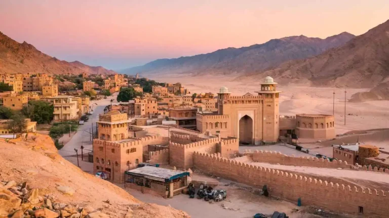
Healthcare remains a challenge, particularly for women and children, as access to essential services is often limited. The region’s topography includes plains, deserts, rivers, lakes, and forests, with the Suleiman Mountains and Kirthar Hills forming natural boundaries. The Bolan Pass and Takht-e-Suleiman are historically significant routes. The Sub-Himalayas and Siwaliks, along with Rawalpindi’s Sakesar at 1,500 meters, shape the overall landscape. Other notable ranges include Safed Koh, Waziristan Hills, Khojak Pass, Khyber Pass, Baroghil Pass, Tochi Pass, and Gomal River.
Further extending into Pakistan’s geography, the Nagan Range, Brahvi Range, and Pab Range contribute to the region’s rugged terrain. The Kohistan area, influenced by the Indus River and the Arabian Sea, connects the district to broader ecological zones. The Himalayan, Karakorum, and Hindu Kush mountain ranges extend into the region, with peaks like Tirich Mir (7,690 meters) and Nanga Parbat (8,126 meters) standing tall. Glaciers like Baltoro, Siachin, and Batura impact the climate and water supply.
Historically, Dera Bugti has witnessed various settlements and migrations. During colonial rule, the region faced multiple conflicts, but after Pakistan’s independence, governance structures evolved. The Marri-Bugti Hills have long been home to indigenous communities, who have preserved their traditions despite modernization. The district continues to struggle with infrastructure development, but efforts are being made to improve essential services.
With its rich history, Dera Bugti remains a key region in Balochistan, Pakistan. The district’s cultural heritage, tribal influence, and strategic location make it a significant part of the province’s history and future development.
Dera Bugti: A Land of Rich History and Challenges
Tracing the Past of Dera Bugti
Located in Balochistan, Pakistan, Dera Bugti is a region of historical, political, and economic importance. The area is home to the Bugtis, a major tribal group known for their deep connection to the land. Historically, Dera Bugti has been significant due to its strategic location, sharing borders with Sindh, Punjab, and Khyber Pakhtunkhwa. It has also been a key passage for trade and migration. The region’s past is marked by its role in the British colonial administration, which saw it as a valuable yet difficult-to-control territory. The tribal system has remained dominant even after independence, shaping local governance and politics.
One of the most notable figures in the history of Dera Bugti was Nawab Akbar Bugti, a respected tribal leader who played a key role in Baloch politics. His leadership was central in the region’s struggle for autonomy and representation. However, tensions between nationalist movements and the government led to repeated conflicts. The situation escalated in 2006, when a military operation resulted in his martyrdom, fueling further rebellion and instability. This led to widespread displacement, forcing many people to become refugees in other parts of the province.
Economic and Natural Resources
The Sui gas field is one of the most valuable natural resources in Dera Bugti, supplying a significant portion of Pakistan’s energy needs. Despite this, the local economy has struggled, with limited development and basic infrastructure. Many tribes still rely on agriculture and livestock for survival, with the rugged terrain and arid climate making farming difficult. The region also holds potential for mineral extraction, but concerns over resource utilization and fair distribution have led to ongoing debates.
In recent years, China’s investments under CPEC have brought attention to the region’s economic potential. Plans for an energy pipeline and transport projects aim to improve connectivity and trade. However, local communities demand greater involvement in decision-making to ensure that development benefits local governance and does not lead to further exploitation.
Challenges in Education and Healthcare
One of the biggest struggles for Dera Bugti is access to education and healthcare facilities. The literacy rate remains low, with traditional tribal structures and security concerns limiting opportunities for formal education. Many children, especially girls, do not have access to proper institutions, and efforts for curriculum reforms and teacher training face obstacles.
Similarly, the lack of hospitals, clinics, and maternal and child care services results in high mortality rates. Basic sanitation, vaccination, and disease prevention programs are insufficient, requiring urgent government policies and humanitarian aid. Some non-governmental organizations (NGOs) are working to improve conditions, but restrictions on press access and media coverage make it hard to highlight these issues internationally.
Cultural Heritage and Traditions
Despite its struggles, Dera Bugti is rich in cultural heritage. The region is known for its Balochi, Brahui, Pashto, and Urdu languages, with strong traditions of storytelling, oral history, and folklore. Music, poetry, and dances are an important part of the tribes’ identity, reflecting their resilience and pride. Handmade embroidery, rugs, and other arts and crafts are also significant, contributing to local trade and economic activities.
However, the impact of conflicts and security restrictions has limited the preservation of archaeological and ancient sites. Efforts to establish museums, organize exhibitions, and conduct academic studies face numerous challenges. Scholars have proposed international collaborations to protect and document the rich history of Dera Bugti, but these projects often face delays.
Security and Political Landscape
The presence of armed groups, military interventions, and negotiations for peace has defined Dera Bugti’s politics for decades. The government has attempted multiple peace dialogues and agreements, but deep-rooted resistance remains. Security checkpoints and movement restrictions continue to affect daily life, limiting access to economic opportunities and essential services.
Political representation in the Senate and National Assembly remains a critical issue, with demands for better local governance and a fair share of federal resources. Elections, alliances, and the influence of political parties continue to shape the region’s future, with tribal leaders playing a significant role in decision-making.
Future Prospects and Development
Looking ahead, Dera Bugti holds potential for sustainability, economic uplift, and reforms. New transport infrastructure projects, renewable energy initiatives, and foreign investments could transform the region. However, achieving long-term stability requires addressing fundamental human rights concerns, improving law and order, and ensuring that government policies prioritize the needs of the local population.
With increased media coverage, investigative journalism, and global attention, there is hope for a balanced approach that promotes economic growth, strengthens local industries, and upholds the traditions and identity of Dera Bugti. The role of entrepreneurship, small enterprises, and digital transformation could further integrate the region into emerging markets, creating new pathways for business growth and employment.
The resilience of the people, combined with well-planned governance and regional cooperation, could make Dera Bugti a model for sustainable development in Balochistan and beyond.
Governmental Structure of Dera bugti
Pakistan is an Islamic Republic governed by a Federal Parliamentary system. The President is the Head of State, while the Prime Minister serves as the Head of Government. The Executive Government consists of the Federal Cabinet, which includes Ministers and Advisors. The Parliament is divided into two houses: the National Assembly and the Senate. The Judiciary includes the Supreme Court, the Federal Shariat Court, and Provincial High Courts, which uphold the Constitution and interpret laws. The Mohtasib (Ombudsperson) ensures justice at the administrative level.
The National Assembly consists of elected members representing the population of Pakistan. It includes General Seats, Women Seats, and Minority Seats. The Senate, led by a Chairman, plays a crucial role in legislation and amendments, especially on finance bills. Pakistan has four provinces, the Islamabad Capital Territory, Gilgit-Baltistan, and the Northern Areas as part of its federation. Each province has a Chief Minister, a Provincial Assembly, and a Provincial Cabinet. The Governor acts as the federation’s representative in provincial matters.
Administrative Units of Pakistan
Pakistan is divided into multiple provinces, territories, and districts. The main provinces are Punjab, Sindh, Balochistan, and Khyber Pakhtunkhwa, while additional territories include FATA, Islamabad Capital Territory, Gilgit-Baltistan, and Azad Kashmir. Each province is further divided into districts, tehsils, talukas, agencies, and frontier regions. The Northern Areas remain a disputed territory, adding complexity to Pakistan’s administrative structure.
Tourist Attractions and Heritage Spots in Pakistan
Pakistan is home to breathtaking attractions, including ancient civilizations like Mohen-jo-Daro, Harappa, and Taxila. The Himalayan hill stations attract visitors, offering winter sports and access to towering mountain peaks, including K2, which is among the highest summits at 8,000 meters (26,250 ft). Adventurers and mountaineers from across the world visit for challenging expeditions.
In Balochistan, there are famous caves such as Juniper Shaft Cave, Murghagull Gharra, and Mughall Saa. Tourists interested in history can explore historical fortresses, towers, and buildings associated with Alexander and other great figures. The Jhelum River and Lahore, known as a cultural center, showcase Mughal architecture at landmarks like Badshahi Masjid, Shalimar Gardens, and the Tomb of Jehangir.
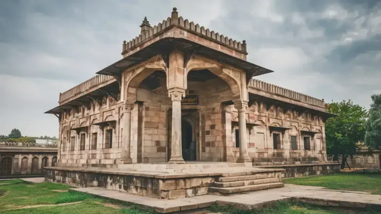
Several locations in Pakistan hold World Heritage status, such as Larkana, Rawalpindi, and Takht-e-Bahai. Other well-preserved sites include Rohtas Fort in Jhelum, Mehrgarh in Sahiwal, and the Bolan Pass. Quetta’s ancient history is reflected in Ranighat and Rehman Dheri. The Baltit Fort in Hunza Valley and Chaukhandi Tombs are also significant cultural landmarks.
Other key historical sites include Hiran Minar in Sheikhupura, the Mansehra Rock Edict, and the Port of Bhambore. Sindh’s Rani Kot Fort in Jamshoro is one of the world’s largest forts. Religious sites like Tomb of Bibi Jawindi in Uch Shareef and Hazrat Rukn-e-Alam in Multan showcase the deep spiritual and architectural heritage of Pakistan. The Federal and Provincial Governments actively work to protect these historical sites and promote tourism as a vital economic sector.