Khuzdar A City of History and Potential
Khuzdar
Nestled in the heart of Balochistan, Khuzdar is an important city serving as the administrative headquarter of Khuzdar District. It is the 3rd-largest city of the province and ranks 48th-largest in Pakistan by population, with an estimated 997,214 people in 2023. Historically, it was the main capital of Jhalawan and played a key role in the Khanate of Kalat. Over the years, it has been part of the Balochistan States Union, later included in the newly formed Kalat Division in 1955 and recognized as a district in 1974. Before this, Gresha was its sub-tehsil, located almost 80 km away. The Brahui-speaking population here is the largest in the region.
Strategic Location and Historical Significance
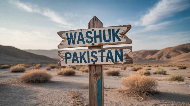
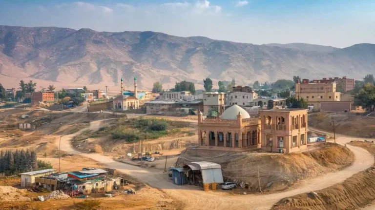
Among the towns and cities in Balochistan, Khuzdar holds a unique position. Though small-sized when compared to urban centers in other provinces, it is an important city in Khuzdar District, Balochistan, Pakistan. The city is situated along the National Highway, a critical route linking Pakistan, Iran, and Turkey. It lies 400 km from Karachi and 300 km from Quetta, making it a major transit point for the country. During the Arab rule, this region was part of the province of Turan, and Khuzdar served as its capital. It was an important cantonment and the headquarters of an Arab General Commanding the Indian frontier.
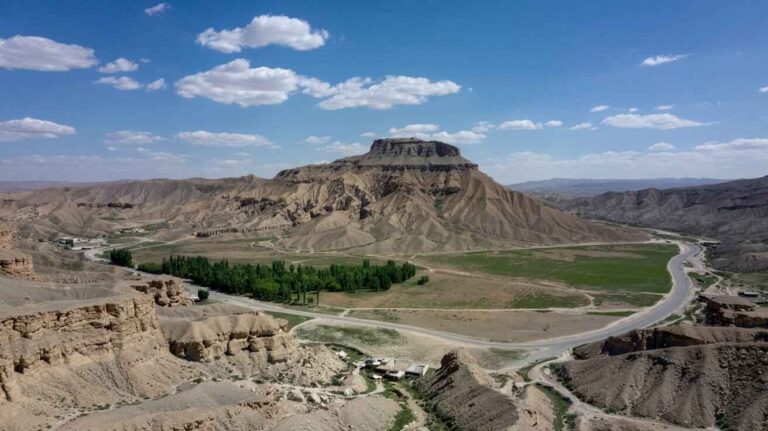
Later, it became part of the Kalat State, where a battle occurred between the people of Jhalawan and the Khan of Kalat in 1869. Mir Khuda Khan emerged victorious and built a fort that still stands today. The town contains remnants of painted pottery, and ruins of an old fort, reflecting the deep influence of the Arabs when Khuzdar was their capital. In 1974, the district was upgraded from being part of the Kalat District to an independent administrative unit. It became a divisional headquarters, further divided into four tehsils: Zehri, Naal, Wadh, and Khuzdar itself. Positioned at the apex of a narrow valley, it sits at an elevation of 1,237 m (4,000 feet) above sea level.
Demographics and Tribal Composition
99% of the people in Khuzdar are Muslims, and its population in 2005 was estimated at 525,000. The major tribes include Gongav, Bizenjo, Mardoi Jattak, Hasni, Siapad, Nausherwani, Sajidi, Mengal, Zarakzai, Ahmadzai, Rekizai, Sasoli, Kurd, Rind, Lund, Alkhani, Buzdar, Rustamani, Kaloi, and Jamali. With a large military complex nearing completion, Khuzdar will host the second-largest Cantonment in Balochistan, after Quetta.
Education and Infrastructure
A university is located on the outskirts of Khuzdar, marking it as an educational hub in the heart of Balochistan. The city, positioned on the National Highway linking Pakistan, Iran, and Turkey, also has an airport nearby. Previously, the university operated as a college, but a newly constructed campus now sits in the foothills, covering an area of 200 acres (0.81 km²).
Geography and Climate
Balochistan is the westernmost province of Pakistan, bordered by Iran to the west, Afghanistan to the northwest, Khyber Pakhtunkhwa and Punjab to the northeast and east, Sindh to the southeast, and the Arabian Sea to the south. The indigenous population dates back to the Stone Age and Bronze Age, with historical links to Alexander the Great’s empire. Baloch settlements appeared in the 14th century CE, followed by Pashtun (Pathan) ethnic groups and Sindhis. The main languages spoken are Balochi, Brahui, Pashto, and Sindhi. The province was declared separate in 1970, making it Pakistan’s largest but sparsely populated region, with Quetta as its capital.
There are four major physical regions:
- Upper highlands in the central-northeastern areas, bounded by the Sulaiman Range in the east and the Toba Kakar Range in the northwest
- Lower eastern slopes of Makran, Kharan, and Chagai in the west
- Pab and Kirthar in the southeast
- Flat plains, coastal regions, and mountains in the northwest
The Chagai, Kharan, and Makran deserts experience arid conditions with swamps near Lora and Mashkel. The Indus River and Arabian Sea influence the region, which is outside the Asian monsoon zone and experiences a dry continental climate with extreme heat and cold.
Economy and Agriculture
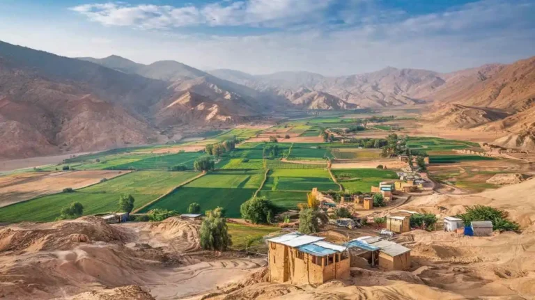
Agriculture is limited due to the scarcity of water, power, and transportation facilities. The main crops include wheat, jowar (sorghum), and rice for food, along with fruits and cash crops. Sheep raising is significant, and high-quality wool is exported. The small-scale industry focuses on cotton, woolen manufacturing, food processing, carpet weaving, textiles, leather, embroidery, small machinery, appliances, and handicrafts.
Challenges and Development Opportunities
Despite its economic contributions, Khuzdar faces poverty and underdevelopment. The Pakistan Poverty Alleviation Fund (PPAF) in 2021 identified high poverty levels, worsened by a lack of infrastructure, such as roads, electricity, and clean water. This affects both businesses and local people. Although Khuzdar is the third-largest city in the province, it still lacks proper gas extraction and distribution methods.
Additionally, ongoing conflicts and security issues have been a concern. Insurgency and militant attacks make it difficult for businesses to operate safely. However, Khuzdar has significant potential for economic development. Its natural resources, if properly harnessed, could boost the economy of Balochistan and Pakistan as a whole, create new jobs, and stimulate economic growth.
To fully unlock its potential, Khuzdar requires government prioritization in areas such as infrastructure, security, and business-friendly policies. Investments in roads, energy, and industries would help transform Khuzdar into a thriving and prosperous city, making it a key contributor to the development of Balochistan and Pakistan.
A university is at the outskirts of Khuzdar
Educational Institutions in Khuzdar
Khuzdar, located in the heart of Balochistan, is home to several educational institutions that serve students from across the province. A university is situated on the outskirts of the city, near the National Highway, which plays a key role in linking Pakistan, Iran, and Turkey. This university was constructed at the foot-hills and spreads over an area of 200 acres (0.81 km²). Due to its strategic location, it provides educational opportunities to students from various regions, including those from remote areas of Balochistan.
Apart from the university, Khuzdar has multiple government and private colleges that cater to different fields of study. Institutions such as Balochistan Residential College, Balochistan University of Engineering and Technology, and Jhalawan Medical College have contributed significantly to higher education. Other well-known institutions include Boys Degree College, Girls Degree College, and Jhalawan Law College, which offer specialized programs for students interested in various disciplines.
School education in Khuzdar is also well-developed, with institutions like Pakistan Public School, Sunrise Public School and College, and Workers Model Higher Secondary School providing quality learning environments. Additionally, the presence of Sardar Bahadur Khan Women’s University ensures that female students have access to higher education within the city. These schools and colleges play a crucial role in shaping the future of students in Balochistan.
Furthermore, specialized colleges like Lasbela University of Agriculture, Water and Marine Science, and Hamdam College of Education offer professional education in various fields. Institutions such as Divisional Public School and College and Al Farooq Residential School provide a strong academic foundation. The presence of such a diverse range of educational institutions highlights Khuzdar as an important educational hub in Balochistan, ensuring that students from all backgrounds have access to quality education.
Demographics, Language, and Religion in Khuzdar
Khuzdar is a growing city with a diverse population spread across its urban and rural areas. According to the 2023 census, the Khuzdar district has 161,450 households, with a total population of 997,214. The sex ratio is 116.84 males per 100 females, indicating a higher number of males. The city has a developing education system, but the literacy rate remains at 38.59%, with 44.91% males and 31.42% females being literate. A significant portion of the surveyed population, about 375,611 (37.67%), is below the age of 10 years, showing that a large percentage of the people are young. Additionally, 364,378 (36.54%) of the population resides in urban areas, contributing to the city’s social and economic growth.
Islam is the predominant religion in Khuzdar, with almost the entire population following it, as recorded in the 2023 census. However, a small minority of mostly-urban Hindus also reside in the city. These communities have coexisted for generations, contributing to the city’s cultural diversity. Religious harmony in Khuzdar reflects the broader traditions of Balochistan, where different communities live side by side while maintaining their unique religious practices.
Language plays a vital role in the identity of Khuzdar’s people. The Brahui language is spoken by 78.93% of the population, making it the most widely used language in the region. Balochi follows with 18.74%, while Sindhi is spoken by 1.22% of the people. A small percentage, 1.11%, speaks other languages. The Balochi language is one of the oldest living Indo-Iranian languages, part of the Indo-European family, and classified under West Iranian languages. It is spoken by nearly nine million people as their first or second language in Pakistan, Afghanistan, Iran, and India, as well as within the Baloch diaspora worldwide.
The Balochi language is divided into eastern, southern, and western dialects. The pronunciation varies depending on the region, with the “ph” sound pronounced as /f/ in the east and /p/ in the west. Over time, Sindhi and Persian have influenced Balochi, shaping its vocabulary and phonetics. The literary history of Balochi poetry dates back to the 15th century, with early works written in nastaʿlīq script from the mid-18th century. One of the most notable poets was Jam Durrak, who composed poems at the court of Mir Muhammad Nasir Khan of Kalat. These songs and poems continue to be sung by the Balochs, preserving their rich cultural heritage.
Historically, the 1981 census recorded 82% of households in Khuzdar speaking Brahui as their first language, while 13% reported speaking Balochi. However, the 1998 census did not collect data on Brahui, but it recorded 96.7% Balochi and 1.0% Punjabi speakers. Recent figures from the 2023 census highlight that Greshek sub-tehsil, Nal, and Ornach tehsils have a Balochi-speaking majority, while the Karakh sub-division is primarily Brahui-speaking, with strong tribal influences shaping the linguistic landscape of Khuzdar.
EducationEducation in Khuzdar: Challenges and Opportunities
Khuzdar, a significant region in Balochistan, has long struggled with education system challenges. The Pakistan District Education Rankings, 2017, ranked Khuzdar at 122 out of 141 districts, reflecting its low education score index. This ranking is based on factors such as learning outcomes, gender parity, and retention rates. A lack of investment in schools, teachers, and infrastructure has made education a major issue in this region.
According to 2014-15 data, the literacy rate for individuals 10 years and older was 45%, while among females, it was only 26%. This gender disparity is further highlighted by post-primary access, which remains a major issue. With 87% of schools being primary schools, only 5% offer high school education. The transition from primary to secondary education is extremely limited, discouraging students, particularly girls, from continuing their education.
In 2016-17, the total enrolment in schools was 23,848 students from class 1 to 5, while only 698 students were enrolled in class 9 and 10. The stark drop in numbers reflects the lack of high schools and girls’ schools. Girls’ schools account for only 30% of total schools, highlighting the gender disparity in post-primary access. Parents are often reluctant to send their daughters to distant schools due to safety concerns and cultural traditions.
School Infrastructure and Facilities
One of the biggest hurdles in improving learning outcomes is the lack of basic facilities in government schools. The Alif Ailaan 2017 report found that primary school infrastructure in Khuzdar District ranked 127 out of 155, while middle school infrastructure ranked 133. These rankings show the poor condition of school facilities, which severely impact enrolment and retention rates.
Many schools lack essential services, making the learning environment difficult for students. According to reports:
- 4 out of 5 schools have no electricity, leading to extreme discomfort in the hot summer months.
- 1 out of 3 schools do not have toilets, discouraging girls from attending.
- 1 out of 2 schools have no boundary walls, making them unsafe.
- 1 out of 3 schools lack clean drinking water, affecting student health and concentration.
These conditions force students, especially girls, to drop out, further widening the literacy gap. Schools without safe environments cannot retain students, resulting in low literacy and enrolment rates.
Private Schools and Alternative Education
Despite these challenges, private schools have emerged as an alternative, offering better facilities and a structured curriculum. Currently, Khuzdar District has 48 private schools, catering to families who can afford them. The first private school, Sunrise School, was established in 1992 and remains one of the most reputed institutions in the district.
However, private schools are not a solution for widespread educational issues, as many families cannot afford the high fees. Government intervention is essential to improve public schools and provide affordable education for all.
The Need for Educational Reforms
Addressing the education crisis in Khuzdar requires policy changes and increased funding. The government must prioritize the construction of more high schools to improve post-primary access. Special attention should be given to girls’ education, ensuring that schools have basic facilities like toilets, boundary walls, and drinking water.
Investing in teacher training programs is also essential to improve learning outcomes. Without qualified teachers, even well-equipped schools cannot provide quality education. Encouraging local teachers, particularly female educators, will help increase enrolment and gender parity in schools.
Additionally, scholarships and financial aid should be introduced for low-income families, reducing dropout rates and ensuring that education is accessible to all. Non-governmental organizations (NGOs) and community-driven initiatives can also play a role in education reform, bridging the gaps left by the government sector.
The education system in Khuzdar is in urgent need of improvement. While private schools provide an alternative, the majority of students rely on government institutions. Without addressing infrastructure issues, gender disparity, and retention rates, the district will continue to struggle with low literacy and educational stagnation. Investing in better facilities, more high schools, and qualified teachers is the only way to create a brighter future for the youth of Khuzdar.
History of Khuzdar District
Historical Legacy of Khuzdar
Khuzdar has been a historically rich region, once part of the Kalat State and a significant part of Jhalawan. In ancient times, it was ruled by the Rai dynasty of Sind, with its influence extending to Turan and beyond. The city’s strategic location near the Mula Pass made it a key capital along ancient trade routes. The region’s importance is further highlighted by the presence of Choarene, Kohiar, and Kandahar, linking Afghanistan, Seistan, and Persia. The Suleiman hills and Kaikanan provided a natural defense, making it an ideal site for settlement and fortification. The remains of Nal reflect early human habitation and connections to Arab conquests.
The Arab army, led by commanders like Muawiyas, Al-Manzar, and Al-Jarud-al-Abdi, left a lasting impact on Kusdar, as recorded by Al Biladhuri. During the Ghaznavid Empire, Sultan Nasir-ud-Din Sebuktigin and later Mahmood Ghaznavi took control, demanding tribute from local rulers, including 15 elephants in 997 AD. His successor, Maudud, maintained authority until the Ghorids and Nasir-ud-din Kabacha of Multan struggled for dominance. Later, Shamsuddin Altamash extended his influence, followed by Malik Bahram Shah, who faced invasions by the Mongols. During the 14th century, the Soomra dynasty and Samma dynasty controlled the area, with Jat tribes and the Brahvi tribe establishing power under Mir Bijar Khan and Mir Chakar Khan Rind.
Under Mughal rule, Zehri tribe leaders served as local administrators of Kalat Princely State. The naib of Jhalawan/Khuzdar played a significant role in managing affairs, as documented by Henry Pottinger in 1810. The region remained crucial in trade between Multan, Shikarpur, and Lasbela, with the influence of local Brahmin and tribal leaders like Noor ud-Din Mengal and Jam Mir Khan. The British Government gained control in 1869, suppressing revolts such as the 1893 rebellion led by Gauhar Khan in Garmap. By 1895, Kalat State troops and a political agent were stationed in the region to maintain order.
With the Partition of India, Khuzdar became part of Pakistan, and in 1st March 1974, it was formally separated from Kalat District. The Imperial Gazetteer of India and later the District Development Profile by UNICEF provided detailed records of its administration. The Balochistan District Gazetteer Series (1907) and CoPakistan 1998 also documented its cultural and political transitions. Historical accounts like Abul Fazal’s Akbarnama (1590) during Emperor Akbar’s reign mention its significance, with Henry Pottinger, an Anglo-Irish Colonial Administrator, writing extensively about its tribal dynamics.
The district is home to rich archeological remains, including gabarbands, Ahmad Band, Pir Munaghara, Sarona, Pandran, tombs, Kufic inscriptions, and super terrene burials. Excavations at Meri Bhar and Palace Mound have uncovered earthen vessels linked to early Kurd inhabitants. Historical sites such as Shahi Bagh, ancient dams, and tombs continue to reflect the grandeur of Khuzdar’s past.
Administrative Setup of Khuzdar
The governmental structure of Khuzdar operates at both the federal level and provincial level, with representation in the National Assembly through 1 seat and in the Provincial Assembly with 3 seats. Under the Local Government Act, 2010, revised in 2011, the District Council governs 40 Union Councils, ensuring 33% representation for women and 5% for workers and peasants. The administrative divisions cover 35,380 km², consisting of multiple Tehsils, with Khuzdar Tehsil as the headquarters, overseeing 11 Union Councils, while Zehri Tehsil has 3, Moola Tehsil has 4, Nal Tehsil has 7, and Wadh Tehsil has 9. Additionally, Municipal Committees manage urban areas, including Khuzdar, Wadh, Nal, and Zehri, playing a vital role in local governance.

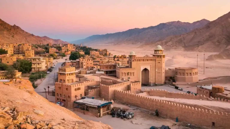
Tourist Attractions and Heritage Sites of Khuzdar
The district of Khuzdar is located at the centre of Balochistan, positioned along the National Highway, making it accessible from Quetta, the capital city of Balochistan, and Karachi, with a distance of 300 km. The region’s valley setting, at an elevation of 1,237 m (4,000 feet), offers scenic landscapes and a rich history dating back to the Umayyad Caliphate, when the city served as the capital of the Turan province. Over time, the area retained its importance under various rulers, including the Sasanian Empire, Abbasid rule, and Ghaznavid dynasty. The region was also a key route between Iran and north-west Balochistan, connecting Qandabil, Kalat, and Multan through historic caravan trade routes.
Among government-protected heritage sites, the archeological ruins of Meri Bher and Palace Mound stand out, showcasing remnants from the time of the Mongol governor, Malik Chap, and early Kurd inhabitants. The remains of forts, tombs, and painted pottery reflect Khuzdar’s ancient significance. Another important site is Shahi Bagh, a historic structure that has seen various rulers and is surrounded by Halwai Peak, which stands at 2,160 m. Inscriptions and relics found here indicate a blend of cultural influences from the Arabs, Sassanids, and British colonial administrators.
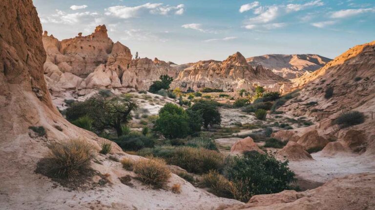
The region is also home to the Pir Omar Shah Noorani Shrine, which attracts visitors from all over Balochistan due to its spiritual importance. Many people visit for pilgrimage and also enjoy the nearby Pir Umar Picnic Spot, known for its natural beauty. Similarly, Moola Chotok, located in Moola Village, is a famous waterfall hidden in the rugged foot-hills. The surrounding area offers an incredible picnic area for nature lovers. Another hidden gem is Charoo Falls, situated in Charoo Village, a peaceful retreat for those looking to escape the busy city life.
Throughout history, Khuzdar has served as a divisional headquarters and was previously part of Kalat District before being established as Khuzdar District on 1st March 1974. The region has always been strategically significant, from its role in the Khanate of Kalat to its connection to the Jhalawan Kingdom in the 17th century. Several historical battles took place here, including revolts against the rule of Khudadad Khan (1857-1893), before British authority was restored through a treaty. The presence of British political agents by 1903 further shaped the region’s governance, leading to its formal incorporation into Pakistan in 1947.
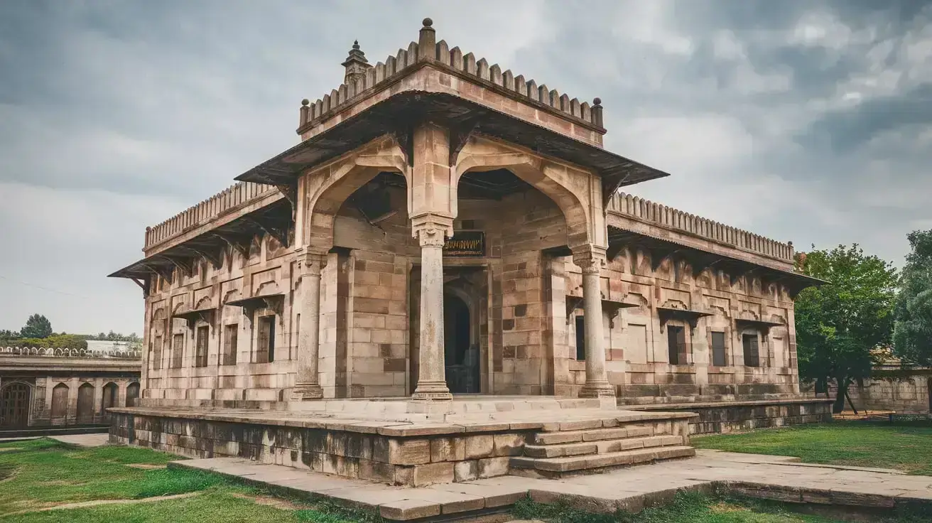
The Main Mosque in Khuzdar city is an architectural landmark that blends modern Islamic architecture with traditional influences. Located near the RCD Highway, the mosque serves as a spiritual and community hub. The region also holds remnants of Choarene, as described by Greek historians, emphasizing Khuzdar’s significant role in the history of Balochistan. Maps from 1680 by William Baffin and 1740 by Seutter highlight Khuzdar’s strategic position, while H. Moll’s 1715 map lists it as Kordar.
One of the most well-preserved historical locations is Kohiar Fort, situated on Meeri Buth hilltop in Union Council Obhan. This fort was constructed by Sassanid governors of Sindh using stone and mud, covering an area of approximately 10 acres. Its walls, measuring three feet thick, were later repaired under the patronage of Arab governors. Over time, forts like this were destroyed to protect the area, as mentioned in the Balochistan District Gazetteer Series, Jhalawan (1907). Similarly, Halwai Peak Fort, Shahi Bagh Fort, and Khan Khudadad Khan Fort continue to tell the tale of Balochistan’s second-biggest city’s long history.
The Shahi Bagh Fort, which once stood on 20 acres of land, had high towers and five-feet-thick walls. Today, it lies in ruins near the Khuzdar-Karachi road, with pieces of pottery and Hindu temples scattered around its neighborhood. Government buildings were later constructed on this site in Lizo Union Council, but findings suggest that the fort was at least 300 years old. Another historical structure, the Khan Kalat Kachehri, was built in 1872 by Khan-i-Qalat Mir Khudadad Khan Ahmedzai, located at the heart of the city on Muhammad Ali Jinnah Road.
British explorers such as Henry Pottinger (1810) and Captain P. J. Maitland (1881-82) documented their travels through Khuzdar while passing through its fortified caravan routes. Historical records indicate that 50 infantry soldiers, 60 Brahui levies, and artillerymen with two cannons were stationed in the city to protect trade routes. Over time, these historic landmarks have suffered from natural decay, neglect, and land encroachments. The Balochistan government has been urged to preserve and document these sites for tourism and cultural heritage protection.
Population
| District/Tehsil | Areakm2 | Population | Male % | Female % | Urban % | Growth Rate % |
| Khuzdar District | 35,380 | 802,207 | 52.5 | 47.5 | 34.5 | 3.49 |
| Khuzdar Tehsil | NA | 331,412 | ||||
| Nal Tehsil | NA | 131,510 | ||||
| Wadh Tehsil | NA | 213,771 | ||||
| Zehri Tehsil | 102,129 | |||||
| Moola Tehsil | 23,385 |
Table 1.4 Khuzdar Population Statistics
Religions Khuzdar district
| Muslims | 99.1% |
| Christians | 0.1% |
| Hindus | 0.6% |
| Ahmadis | 0.1% |
| Scheduled Castes | 0.2% |
| Others | Negligible % |
Table 1.5 Khuzdar Religions
Languages Khuzdar district
| Urdu | 0.2% |
| Punjabi | 1.0% |
| Sindhi | 0.6% |
| Pushto | 0.4% |
| Balochi | 96.7% |
| Seraiki | 0.1% |
| Others[3] | 1.0% |