Kalat A Historic Stronghold in Balochistan
Kalat A Historic Stronghold in Balochistan
Kalat District
Kalat is one of the historic districts of Balochistan, Pakistan, known for its mountainous landscape, arid climate, and rich cultural heritage. The region has been a significant administrative unit since February 3, 1954, when it became part of Kalat Division. Over time, various sub-divisions were formed, including Khuzdar, Mastung, and areas that now belong to Kachhi District, created on March 1, 1974. Later, on February 18, 1992, further administrative changes reshaped the district.
The district headquarters is located in Kalat, a city that has played an essential role in regional politics and trade. Several tehsils, including Mangochar, Johan, Gazgz, and Kahan, are part of this district, making it an important economic and agricultural hub. The area comprises 81 Patwar circles and around 614 mauza villages, each contributing to the local economy.
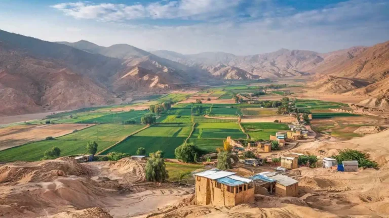
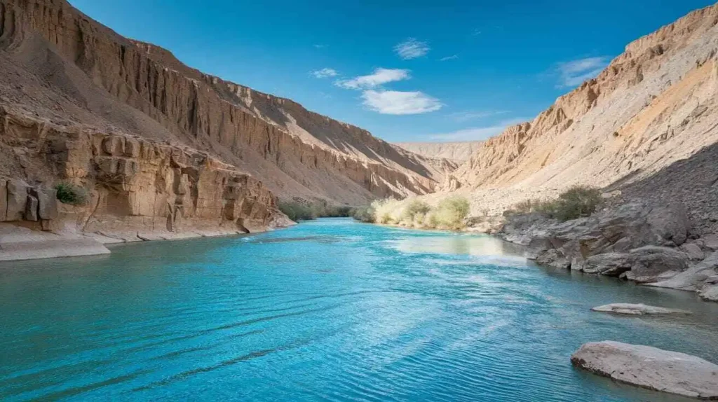
Geographically, Kalat features a mountainous terrain with deep valleys and seasonal rivers. The famous Mount Harboi stands tall, covered with ancient Juniper trees, adding to the district’s natural beauty. The Moro River is another key feature, supporting agriculture and livestock farming, which are primary economic activities. Despite its arid nature, the region sustains crops and animals through traditional farming methods.
The climate is extreme, with hot summers and cold winters. The rainfall is minimal, making water resources a crucial concern for the locals. The rugged landscape and valleys define the region, adding both beauty and challenges to daily life.
Historically, Kalat was ruled by the Khan of Kalat, a powerful leader who held a ceremonial title. Today, the current Khan, Mir Suleman Dawood Jan, remains an influential figure, although his political role has diminished. His son, Prince Mohammed, represents the lineage, while some members of the family have sought to reconcile their position with the Pakistani government. The region has a history of both pro-Pakistan and independent movements, reflecting its complex political past.
The local population is diverse, with Brahui and Baloch communities forming the majority. Urdu is also spoken, especially in urban centers, but the dominant language remains Brahui. Historically, Hindkowan merchants, representing about two percent of the population, settled here and contributed to trade.
The region’s economy relies on agriculture and livestock farming, with wheat, barley, and fruits being the main produce. Additionally, minerals such as coal, iron ore, and sulfur have been discovered, offering potential for economic development. Traditional crafts, including pile carpets, embroidery, and leather products, remain important to local livelihoods.
Administratively, Kalat Division covers a vast area of 140,612 km² and includes districts like Awaran, Khuzdar, Lasbela, Mastung, Surab, and others. In 2015, the Balochistan Assembly passed a unanimous resolution to establish a new administrative unit called Rakhshan, incorporating Nushki, Chagai, Kharan, and Washuk, reshaping the province’s governance.
The climate varies across different areas, with moderate summers in high-altitude regions and snowy winters in some parts. July is typically the warmest month, with an average temperature of 24.8°C, while January, the coldest month, drops to around 3.4°C. The precipitation is generally low but sufficient to support limited farming of wheat, barley, melons, jowār, and sorghum.
Natural resources such as coal, iron ore, and sulfur are found in the region, though large-scale extraction is still underdeveloped. The district’s sparse population, mainly consisting of Brahui and Baloch ethnic groups, continues to rely on traditional livelihoods.
Kalat District: A Journey Through History
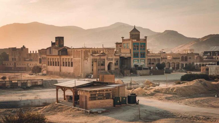
Kalat, located in Balochistan, Pakistan, has a history that stretches back centuries. It was once known as Kalat-e-Baluch, Kalat-e-Ghilzai, and Qalat-e-Ghelzai in different periods. Some records also refer to it as Kalat-e-Sewa, a name linked to ancient times. The district is surrounded by rugged mountains and lies within Kalat valley, which has been home to different civilizations over the years.
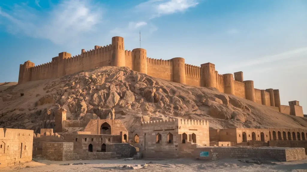
The region gained historical importance when it became a stronghold for the MirwariAḥmadzai dynasty in the 15th century. The Mirwaris, believed to be of Brahui origin, established their rule over Kalat and other areas. They were considered a formidable force during their time. Minhaj-i-Siraj, a historian, mentioned Kalat’s strategic location near eastern Seistan in his writings. The region was also referenced in historical texts such as Tabakat-i-Nasiri, Tarikh-i-Harat, and Tarikh-i-Sistan, which highlight its political and military significance.
During the 12th and 13th centuries, Kalat saw multiple uprisings by local tribes. These revolts were often linked to resistance against foreign influences, including rulers from Afghanistan. Some historians associate this period with the influence of Caliph Al-Mahdi of the Abbasid dynasty. Later, in the 16th century, Kalat came under the focus of Persian rulers like the Safavids and regional leaders such as Lashari and Sistan Khan. The region’s governance changed hands multiple times, including periods of control by the KermanianBeglar-Begi and other Persian officials.
The Khanate of Kalat was formally established in 1666 under Mir Ahmad Khan, marking the beginning of a significant political era. The Khan of Kalat ruled over vast territories, including Quetta, Mastung, Mangocher, and Chagai. The Mughals also played a role in shaping the region’s history. During 1667, Mughal forces, led by Samandar Khan, entered Kalat, which led to power struggles between the Mughals, Kerman, and the Safavids. Kalat’s rulers had to pay tribute in gold to maintain autonomy.
By 1758, NooriNaseer Khan emerged as a powerful ruler, bringing stability to the region and resisting external control. Kalat later became linked with the Durrani Empire, further strengthening its political influence. However, as the British expanded their rule in South Asia, they sought control over Kalat.
In 1839, the British forces occupied Kalat, marking the beginning of foreign intervention. By 1842, the British appointed a political agent to oversee the region’s affairs. Despite resistance from the Baloch, Kalat remained under British influence until 1948, when it was integrated into Pakistan.
During the struggle for Pakistan’s independence, Kalat’s leadership, including the Khan of Kalat, played a complex role. Many discussions took place between Muhammad Ali Jinnah and Kalat’s ruling elite. Eventually, Kalat joined Pakistan in 1948, though some factions opposed the move. Over time, the Pakistani government worked to reconcile differences with Kalat’s leaders.
Kalat has also seen various political shifts at the national level. Figures like Liaqat Ali Khan, Iskander Mirza, Zulfikar Ali Bhutto, and Pervez Musharraf have influenced the region through their policies. The Pakistan People’s Party (PPP), Pakistan Muslim League (PML), and other political groups have played roles in shaping Kalat’s modern governance. The region has also been affected by national events such as the First General Elections (1970), the Civil War and Formation of Bangladesh (1971), and Musharraf’s Coup (1999).
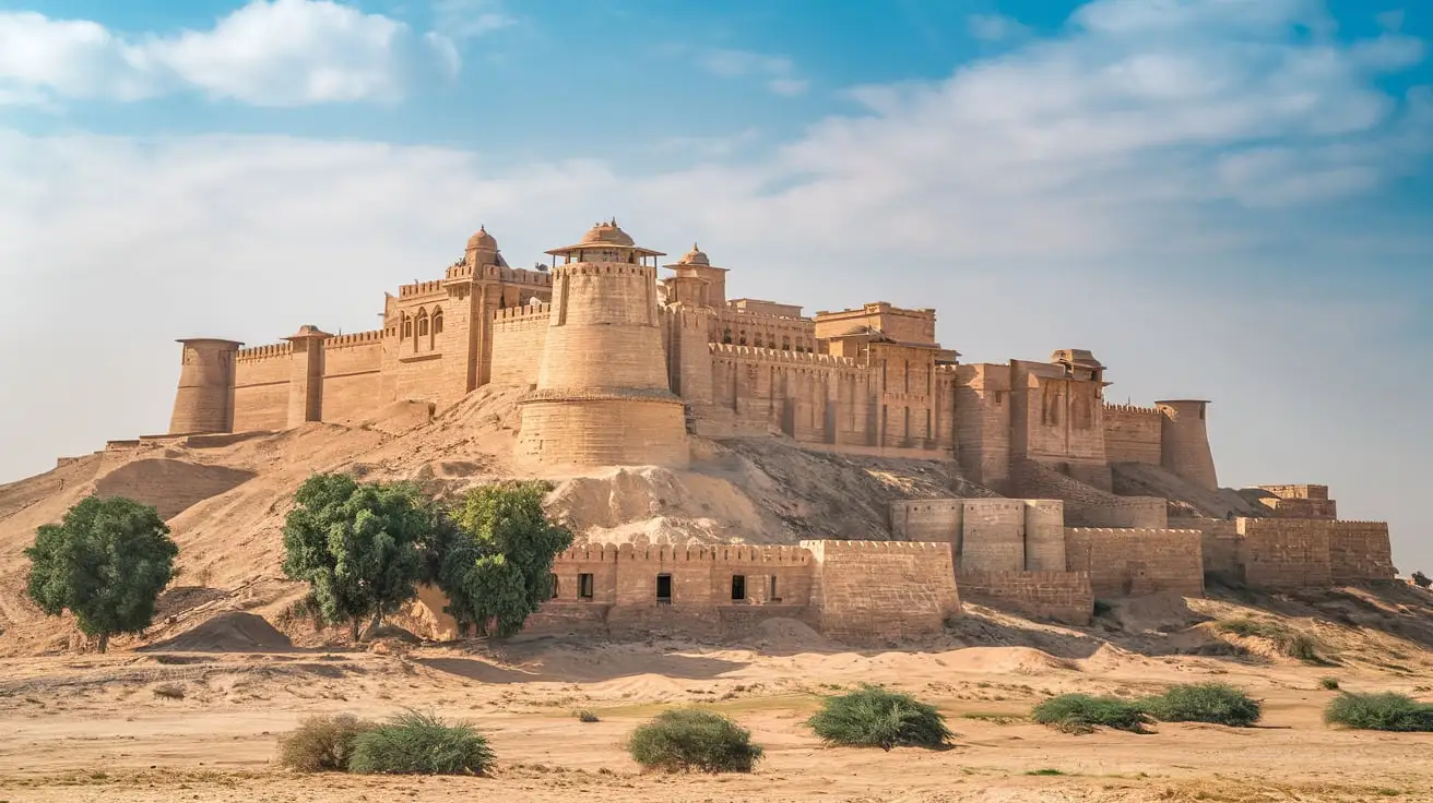
Kalat has faced several challenges over the years, including a devastating earthquake in 1935 that destroyed much of the Miri citadel and the palace of the khans. Despite these hardships, Kalat has remained an important part of Balochistan and continues to hold historical significance in Pakistan.
Education in kalat
Kalat, a significant district in Pakistan, has long struggled with education challenges. According to the Education Rankings 2017, it was ranked number 66 out of 141 districts on the education score index. Factors like learning, gender parity, and retention were considered in these rankings. The literacy rate in 2014–15 stood at 54% for the population 10 years and older, while for females, it was just 45%. The post-primary access issue is evident, with 83% schools at the primary level, whereas high schools make up only 9% of government schools. The enrollment figures for 2016–17 reflect this gap, with 20,031 students in class 1 to class 5, but only 658 students in class 9 and class 10.
The gender disparity in education is concerning, as only 34% of schools are for girls, limiting their access to learning. The low literacy among females is further worsened by the lack of basic facilities. As per Alif Ailaan, Kalat was ranked 128 out of 155 for primary school infrastructure and 136 for middle school level. Schools struggle with facilities such as drinking water, toilets, electricity, boundary walls, and overall building condition. Shockingly, 4 out of 5 schools have no electricity, nearly 1 out of 2 lack a toilet and a boundary wall, and 1 out of 3 do not have clean drinking water, making education even more difficult for students.
Administration
The Kalat Administration has evolved over time, from the rule of khans to British occupation (1839) and later integration into Pakistan (1948). Today, it operates under Balochistan’s governance, managing local affairs, law enforcement, and development initiatives for the district.
| # | Tehsil | Area (km²) | Population (2023) | Density (ppl/km²)(2023) | Literacy rate(2023) | Districts |
| 1 | Awaran Tehsil | 13,075 | 45,774 | 3.50 | Awaran | |
| 2 | Gishkaur Tehsil | 4,578 | 31,462 | 6.87 | ||
| 3 | Jhal Jhao Tehsil | 6,381 | 28,132 | 4.41 | ||
| 4 | Korak Jahoo Tehsil | 3,058 | 27,652 | 9.04 | ||
| 5 | Mashkay Tehsil | 2,418 | 45,938 | 19.00 | ||
| 6 | Gaddani Tehsil | 419 | 29,215 | 69.73 | Hub | |
| 7 | Sonmiani Tehsil | 2,616 | 67,991 | 25.99 | ||
| 8 | Hub Tehsil | 868 | 233,443 | 268.94 | ||
| 9 | Sakran Tehsil | |||||
| 10 | Dureji Tehsil | 2,813 | 52,236 | 18.57 | ||
| 11 | Kalat Tehsil | 3,788 | 167,405 | 44.19 | Kalat | |
| 12 | Mangochar Tehsil | 1,148 | 80,138 | 69.81 | ||
| 13 | Gazg Tehsil | 1,390 | 8,286 | 5.96 | ||
| 14 | Johan Tehsil | 1,328 | 15,731 | 11.85 | ||
| 15 | Khuzdar Tehsil | 6,112 | 359,358 | 58.80 | Khuzdar | |
| 16 | Nall | 1,791 | 103,631 | 57.86 | ||
| 17 | Wadh | 2,118 | 116,229 | 54.88 | ||
| 18 | Zehri Tehsil | 4,021 | 150,928 | 37.53 | ||
| 19 | Baghbana Tehsil | |||||
| 20 | Aranji Tehsil | 7,456 | 50,533 | 6.78 | ||
| 21 | Greshek Tehsil | 2,622 | 69,665 | 26.57 | ||
| 22 | Karkh Tehsil | 1,352 | 35,990 | 26.62 | ||
| 23 | Moola Tehsil | 3,283 | 32,689 | 9.96 | ||
| 24 | Ornach Tehsil | 3,368 | 41,811 | 12.41 | ||
| 25 | Saroona Tehsil | 3,257 | 36,380 | 11.17 | ||
| 26 | Uthal Tehsil | 1,756 | 88,933 | 50.65 | Lasbela | |
| 27 | Lakhra Tehsil | 1,954 | 46,744 | 23.92 | ||
| 28 | Bela Tehsil | 1,527 | 129,264 | 84.65 | ||
| 29 | Kanraj Tehsil | 1,190 | 15,996 | 13.44 | ||
| 30 | Liari Tehsil | 2,010 | 17,155 | 8.53 | ||
| 31 | Dasht Mastung Tehsil | 1,047 | 67,935 | 64.89 | Mastung | |
| 32 | Mastung Tehsil | 692 | 162,319 | 234.57 | ||
| 33 | Khad Koocha Tehsil | 640 | 46,316 | 72.37 | ||
| 34 | Kardigap Tehsil | 929 | 36,701 | 39.51 | ||
| 35 | Dasht e Goran | 215 | 27,503 | 127.92 | Surab | |
| 36 | Gidder | 205 | 89,631 | 437.22 | ||
| 37 | Shaheed meharabad zehri | 109 | 66,435 | 609.50 | ||
| 39 | Surab Tehsil | 233 | 95,469 | 409.74 |
Districts
Kalat is one of the important districts of Balochistan, Pakistan. It has historical significance and was once the center of the Khanate of Kalat. The district is known for its rugged landscapes, rich culture, and administrative importance in the province.
| # | District | Headquarter | Area(km²) | Pop.(2023) | Density(ppl/km²)(2023) | Lit. rate(2023) |
| 1 | Awaran | Awaran | 29,510 | 178,958 | 6.1 | 36.34% |
| 2 | Hub | Hub | 6,716 | 382,885 | 57 | 36.47% |
| 3 | Lasbela | Uthal | 15,153 | 680,977 | 44.9 | 36.47% |
| 4 | Surab | Surab | 762 | 279,038 | 366.5 | 37.44% |
| 5 | Mastung | Mastung | 3,308 | 313,271 | 94.7 | 45.97% |
| 6 | Khuzdar | Khuzdar | 35,380 | 997,214 | 28.2 | 38.59% |
| 7 | Kalat | Kalat | 7,654 | 271,560 | 35.5 | 39.70% |
Constituencies
Kalat district is part of the constituencies for both the National Assembly of Pakistan and the Provincial Assembly of Balochistan. It falls under NA-268 for the National Assembly and PB-38 for the Provincial Assembly, representing the region’s political landscape.
| # | Provincial Assembly Constituency | National Assembly Constituency | District |
| 1 | PB-18 Khuzdar-I | NA-256 Khuzdar | Khuzdar |
| 2 | PB-19 Khuzdar-II | ||
| 3 | PB-20 Khuzdar-III | ||
| 4 | PB-21 Hub | NA-257 Hub-cum-Lasbela-cum-Awaran | Hub |
| 5 | PB-22 Lasbela | Lasbela | |
| 6 | PB-23 Awaran | Awaran | |
| 7 | PB-35 Surab | NA-261 Surab-cum-Kalat-cum-Mastung | Surab |
| 8 | PB-36 Kalat | Kalat | |
| 9 | PB-37 Mastung | Mastung |